Cyclocane
( cyclocane is a CYCLOne and hurriCANE tracker by hayley )


Hayley here - Do you like lofi music whatever music Hayley put on and terrifyingly loud computer voices? Then stop by the 24/7 ish severe weather live stream!
* stats delayed and were probably not accurate to begin with
English Español Deutsch Français 日本語
This is the final warning / advisory for this storm as it has weakened below warning levels and/or the storm system is no longer a tropical cyclone.
BERTHA Current Status
Current Wind Speed 30 knots / 35 MPH
Max Predicted Wind Speed 30 knots / 35 MPH at

Current Watches/Warnings / Radar / Satellite
current US watches/warnings

live tornado/thunderstorm tracker - tornadohq
future radar imagery - my future radar

future radar imagery
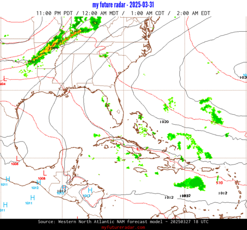
(above image is an example of the Western North Atlantic page - see Atlantic future radar page for a full set of images)
If a tropical storm or hurricane is threatening land, you can check my future radar for an idea of what radar might look like as the storm approaches.
BERTHA Land Hazards
NWS Local Hurricane Statements
- No warnings
- STORM SURGE - Water levels may remain elevated through the next high tide cycle along the Louisiana and Texas coastline but should subside thereafter.
- RAINFALL - The remnants of Bertha are expected to produce total rainfall amounts of 1 to 3 inches with isolated totals to 4 inches tonight over South Texas. This rainfall may produce isolated flash flooding, especially in urban areas.
- SURF - Swells generated by the remnants of Bertha will continue to affect the Louisiana and Texas coast through tonight. These swells are likely to cause life-threatening surf and rip current conditions. Please consult products from your local weather office.
BERTHA Tracker
BERTHA Satellite Loop
BERTHA Alternate Tracking Map
BERTHA Spaghetti Models
Spaghetti models for BERTHA can be found here:
BERTHA spaghetti models page »
BERTHA Watches and Warnings

Remnants Of BERTHA Tropical Cyclone Update
Remnants Of BERTHA Public Advisory
000
WTNT32 KNHC 240233
TCPAT2

BULLETIN
Remnants Of Bertha Advisory Number  19
NWS National Hurricane Center Miami FL       AL022026
1000 PM CDT Thu Jul 23 2026

...BERTHA HAS DEGENERATED INTO A TROUGH...
...THIS IS THE LAST ADVISORY...


SUMMARY OF 1000 PM CDT...0300 UTC...INFORMATION
-----------------------------------------------
LOCATION...30.0N 96.0W
ABOUT 40 MI...65 KM WNW OF HOUSTON TEXAS
MAXIMUM SUSTAINED WINDS...35 MPH...55 KM/H
PRESENT MOVEMENT...W OR 270 DEGREES AT 14 MPH...22 KM/H
MINIMUM CENTRAL PRESSURE...1008 MB...29.77 INCHES


WATCHES AND WARNINGS
--------------------
CHANGES WITH THIS ADVISORY:

None.

SUMMARY OF WATCHES AND WARNINGS IN EFFECT:

There are no coastal watches or warnings in effect.

For storm information specific to your area, including possible
inland watches and warnings, please monitor products issued by your
local National Weather Service forecast office.


DISCUSSION AND OUTLOOK
----------------------
At 1000 PM CDT (0300 UTC), the remnants of Bertha were located near
latitude 30.0 North, longitude 96.0 West. The remnants are moving
toward the west near 14 mph (22 km/h), and this general motion is
expected to continue tonight.

Maximum sustained winds are near 35 mph (55 km/h) with higher gusts.

The estimated minimum central pressure is 1008 mb (29.77 inches).


HAZARDS AFFECTING LAND
----------------------
STORM SURGE:  Water levels may remain elevated through the next
high tide cycle along the Louisiana and Texas coastline but should
subside thereafter.

RAINFALL: The remnants of Bertha are expected to produce total
rainfall amounts of 1 to 3 inches with isolated totals to 4 inches
tonight over South Texas.  This rainfall may produce isolated flash
flooding, especially in urban areas.

For a complete depiction of forecast rainfall associated with
Bertha, please see the National Weather Service Storm Total Rainfall
Graphic available at hurricanes.gov/graphics_at2.shtml?rainqpf and
the Flash Flood Risk graphic at
hurricanes.gov/graphics_at2.shtml?ero.

SURF: Swells generated by the remnants of Bertha will continue to
affect the Louisiana and Texas coast through tonight.  These swells
are likely to cause life-threatening surf and rip current
conditions.  Please consult products from your local weather office.

A depiction of rip current risk for the United States can be found
at: hurricanes.gov/graphics_at2.shtml?ripCurrents


NEXT ADVISORY
-------------
This is the last public advisory issued by the National Hurricane
Center on this system.

$$
Forecaster Pasch
Public Advisory not available for this storm.
Remnants Of BERTHA Forecast Discussion
000
WTNT42 KNHC 240235
TCDAT2

Remnants Of Bertha Discussion Number  19
NWS National Hurricane Center Miami FL       AL022026
1000 PM CDT Thu Jul 23 2026

Surface observations over eastern Texas indicate that Bertha no
longer has a well-defined circulation, and has opened up into a
trough.  Therefore, the system has dissipated, and this will be the
last advisory.

Bertha's remnants will likely continue to produce some locally heavy
rainfall over portions of eastern and southern Texas, where isolated
flash flooding is possible overnight.

FORECAST POSITIONS AND MAX WINDS

INIT  24/0300Z 30.0N  96.0W   30 KT  35 MPH...REMNANTS
 12H  24/1200Z...DISSIPATED

$$
Forecaster Pasch
BERTHA storm path from NHC
| Time | Speed | Location | Status |
|---|---|---|---|
| 30 knots | 30.0, -96.0 | translation missing: en.REMNANTS | |
| 0 knots | DISSIPATED |
site by Hayley Croft
Hi, I'm Hayley. Did you know that I run this site out of my own pocket? So if you'd like to help support this site:
- Tell your friends about Cyclocane
- Buy something through this Amazon Cyclocane link
- make a donation - totally optional but completely appreciated
Make a monthly donation or a one-time donation to help support ongoing costs with Cyclocane.
Play solitaire and track all of the cyclocane storms at the same time at Hurricane Solitaire.