Cyclocane
( cyclocane is a CYCLOne and hurriCANE tracker by hayley )


English Español Deutsch Français 日本語
This is the final warning / advisory for this storm as it has weakened below warning levels and/or the storm system is no longer a tropical cyclone.
MARTIN Current Status
Current Wind Speed 70 knots / 80 MPH
Max Predicted Wind Speed 70 knots / 80 MPH at

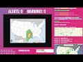
Current Watches/Warnings / Radar / Satellite
current US watches/warnings

live tornado/thunderstorm tracker - tornadohq
future radar imagery - my future radar

future radar imagery

(above image is an example of the Western North Atlantic page - see Atlantic future radar page for a full set of images)
If a tropical storm or hurricane is threatening land, you can check my future radar for an idea of what radar might look like as the storm approaches.
MARTIN Land Hazards
NWS Local Hurricane Statements
- No warnings
- SURF - Swells generated by post-tropical Martin will likely spread across a large portion of the high-latitude North Atlantic basin, affecting portions of Atlantic Canada, the Azores, and the Atlantic coast of Europe by the weekend. These swells are likely to cause life-threatening surf and rip current conditions. Please consult products from your local weather office.
MARTIN Tracker
MARTIN Satellite Loop
MARTIN Alternate Tracking Map
MARTIN Spaghetti Models
Spaghetti models for MARTIN can be found here:
MARTIN spaghetti models page »
MARTIN Watches and Warnings

Post-Tropical Cyclone MARTIN Tropical Cyclone Update
Post-Tropical Cyclone MARTIN Public Advisory
000
WTNT31 KNHC 032032
TCPAT1

BULLETIN
Post-Tropical Cyclone Martin Advisory Number  10
NWS National Hurricane Center Miami FL       AL162022
900 PM GMT Thu Nov 03 2022

...POST-TROPICAL MARTIN CAUSING STRONG WINDS AND HAZARDOUS SEAS
ACROSS A LARGE PORTION OF THE CENTRAL NORTH ATLANTIC...


SUMMARY OF 900 PM GMT...2100 UTC...INFORMATION
----------------------------------------------
LOCATION...50.5N 34.5W
ABOUT 940 MI...1510 KM NNW OF THE AZORES
ABOUT 885 MI...1425 KM ENE OF CAPE RACE NEWFOUNDLAND
MAXIMUM SUSTAINED WINDS...80 MPH...130 KM/H
PRESENT MOVEMENT...NNE OR 20 DEGREES AT 58 MPH...93 KM/H
MINIMUM CENTRAL PRESSURE...950 MB...28.06 INCHES


WATCHES AND WARNINGS
--------------------
There are no coastal watches or warnings in effect.


DISCUSSION AND OUTLOOK
----------------------
At 900 PM GMT (2100 UTC), the center of Post-Tropical Cyclone Martin
was located near latitude 50.5 North, longitude 34.5 West. The
post-tropical cyclone is moving toward the north-northeast near 58
mph (93 km/h). A slower northward to north-northwestward motion is
expected tonight, followed by a much slower turn toward the east on
Friday. An eastward to east-southeastward motion is then
anticipated into the weekend.

Maximum sustained winds are near 80 mph (130 km/h) with higher
gusts.  Martin's peak sustained winds will slowly decrease over the
next few days, but it will continue to produce strong winds over a
very large area well into the weekend.

Hurricane-force winds extend outward up to 70 miles (110 km) from
the center and tropical-storm-force winds extend outward up to 520
miles (835 km).

The estimated minimum central pressure is 950 mb (28.06 inches).


HAZARDS AFFECTING LAND
----------------------
SURF: Swells generated by post-tropical Martin will likely spread
across a large portion of the high-latitude North Atlantic basin,
affecting portions of Atlantic Canada, the Azores, and the Atlantic
coast of Europe by the weekend. These swells are likely to cause
life-threatening surf and rip current conditions. Please consult
products from your local weather office.


NEXT ADVISORY
-------------
This is the last public advisory issued by the National Hurricane
Center on this system. Additional information on this system can be
found in High Seas Forecasts issued by the National Weather Service,
Meteo France, and the UK Met Office. National Weather Service
forecasts are available under AWIPS header NFDHSFAT1, WMO header
FZNT01 KWBC, and online at ocean.weather.gov/shtml/NFDHSFAT1.php
High Seas Forecasts issued by Meteo France can be found under WMO
header FQNT50 LFPW and are available on the web at
www.meteofrance.com/previsions-meteo-marine/bulletin/grandlarge/
metarea2. High Seas Forecasts issued by the UK Met Office can be
found under WMO header FQNT21 EGRR and on the web at
metoffice.gov.uk/weather/specialist-forecasts/coast-and-sea/high-
seas-forecast/.

$$
Forecaster D. Zelinsky
Public Advisory not available for this storm.
Post-Tropical Cyclone MARTIN Forecast Discussion
000
WTNT41 KNHC 032033
TCDAT1

Post-Tropical Cyclone Martin Discussion Number  10
NWS National Hurricane Center Miami FL       AL162022
900 PM GMT Thu Nov 03 2022

ASCAT-C data that was not available until after the issuance of the
last advisory, but was valid at 1317 UTC, showed that Martin likely
became frontal earlier today and the system no longer has a
well-defined circulation. In addition, both TAFB and SAB evaluated
the system as extratropical at 1800 UTC. Therefore, Martin is now
classified as post-tropical and this will be the last NHC advisory.

While Martin does not currently appear to have a well-defined
center, the powerful post-tropical cyclone is expected to redevelop
a well-defined center as it occludes over the next 12 to 24 h.
Martin is moving at a remarkable clip of 50 kt, but should begin to
slow down soon and turn north-northwestward during the next few
hours. After that, the cyclone is forecast to move relatively slowly
on Friday before picking up speed toward the east-southeast or east
through the early weekend. Martin's maximum winds are still forecast
to slowly decrease over the next few days, however the combination
of Martin and other non-tropical low pressure systems are still
expected to produce hazardous wind and seas over a very wide area of
the North Atlantic for the next couple of days.

Additional information on marine hazards can be found in High Seas
Forecasts issued by the National Weather Service, the UK Met
Office, and Meteo France. Links to each product are provided below.

* National Weather Service: AWIPS Header NFDHSFAT1, WMO header
FZNT01 KWPC, and online at ocean.weather.gov/shtml/NFDHSFAT1.php
* UK Met Office: WMO header FQNT21 EGRR and online at
www.metoffice.gov.uk/weather/specialist-forecasts/coast-and-sea/high
-seas-forecast/
* Meteo France: WMO header FQNT50 LFPW and online at
www.meteofrance.com/previsions-meteo-marine/bulletin/grandlarge/
metarea2.


FORECAST POSITIONS AND MAX WINDS

INIT  03/2100Z 50.5N  34.5W   70 KT  80 MPH...POST-TROPICAL
 12H  04/0600Z 55.0N  35.0W   70 KT  80 MPH...POST-TROP/EXTRATROP
 24H  04/1800Z 56.5N  35.0W   60 KT  70 MPH...POST-TROP/EXTRATROP
 36H  05/0600Z 56.5N  31.0W   55 KT  65 MPH...POST-TROP/EXTRATROP
 48H  05/1800Z 55.5N  25.0W   50 KT  60 MPH...POST-TROP/EXTRATROP
 60H  06/0600Z 55.0N  17.0W   45 KT  50 MPH...POST-TROP/EXTRATROP
 72H  06/1800Z...DISSIPATED

$$
Forecaster D. Zelinsky
MARTIN storm path from NHC
| Time | Speed | Location | Status |
|---|---|---|---|
| 70 knots | 50.5, -34.5 | translation missing: en.POST-TROPICAL | |
| 70 knots | 55.0, -35.0 | POST-TROPICAL CYCLONE | |
| 60 knots | 56.5, -35.0 | POST-TROPICAL CYCLONE | |
| 55 knots | 56.5, -31.0 | POST-TROPICAL CYCLONE | |
| 50 knots | 55.5, -25.0 | POST-TROPICAL CYCLONE | |
| 45 knots | 55.0, -17.0 | POST-TROPICAL CYCLONE | |
| 0 knots | translation missing: en.DISSIPATED |
site by Hayley Croft
- Tell your friends about Cyclocane
- make a donation - totally optional but completely appreciated
Make a monthly donation or a one-time donation to help support ongoing costs with Cyclocane.
Play solitaire and track all of the cyclocane storms at the same time at Hurricane Solitaire.