Cyclocane
( cyclocane is a CYCLOne and hurriCANE tracker by hayley )
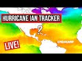


Hurricane Watch - Tampa Bay Area - Ruskin FL AL092022
000
WTUS82 KTBW 291530
TCVTBW
URGENT - IMMEDIATE BROADCAST REQUESTED
Ian Local Watch/Warning Statement/Advisory Number 28
National Weather Service Tampa Bay Area - Ruskin FL AL092022
1130 AM EDT Thu Sep 29 2022
FLZ139-291630-
/O.CAN.KTBW.TR.W.1009.000000T0000Z-000000T0000Z/
Coastal Levy-
1130 AM EDT Thu Sep 29 2022
TROPICAL STORM WARNING IS CANCELLED
LOCATIONS AFFECTED
- Cedar Key
- Yankeetown
- Fowler Bluff
- Cedar Key
WIND
- LATEST LOCAL FORECAST: Below tropical storm force wind
- Peak Wind Forecast: 20-30 mph with gusts to 45 mph
- Peak Wind Forecast: 20-30 mph with gusts to 45 mph
- THREAT TO LIFE AND PROPERTY THAT INCLUDES TYPICAL FORECAST
UNCERTAINTY IN TRACK, SIZE AND INTENSITY: Wind less than 39 mph
- The wind threat has decreased from the previous assessment.
- PLAN: The sustained wind should remain less than tropical
storm force. Conditions may still be gusty. - PREPARE: Listen for any instructions from local officials.
- ACT: Ensure emergency readiness should the forecast change.
- The wind threat has decreased from the previous assessment.
- REALIZED IMPACTS: Being Assessed
- Little to no additional wind impacts expected. Community
officials are now assessing the extent of actual wind
impacts accordingly.
- Little to no additional wind impacts expected. Community
- LATEST LOCAL FORECAST: Below tropical storm force wind
STORM SURGE
- No storm surge inundation forecast
- THREAT TO LIFE AND PROPERTY THAT INCLUDES TYPICAL FORECAST
UNCERTAINTY IN TRACK, SIZE AND INTENSITY: Little to no storm
surge flooding
- The storm surge threat has remained nearly steady from the
previous assessment. - PLAN: The threat of life-threatening storm surge is
diminishing as flood waters recede. - PREPARE: Do not return to evacuated areas until flood
waters completely recede and the all-clear is given by
local officials. - ACT: Failure to practice safety may result in serious
injury or loss of life. If you have a life-threatening
emergency, dial 9 1 1.
- The storm surge threat has remained nearly steady from the
- REALIZED IMPACTS: Being Assessed
- Little to no additional surge impacts expected. Community
officials are now assessing the extent of actual surge
impacts accordingly.
- Little to no additional surge impacts expected. Community
- No storm surge inundation forecast
FLOODING RAIN
- LATEST LOCAL FORECAST:
- Peak Rainfall Amounts: No additional significant rainfall
forecast
- Peak Rainfall Amounts: No additional significant rainfall
- THREAT TO LIFE AND PROPERTY THAT INCLUDES TYPICAL FORECAST
UNCERTAINTY IN TRACK, SIZE AND INTENSITY: Little or no
potential for flooding rain
- The flooding rain threat has decreased from the previous
assessment. - PLAN: There is little or no potential for flooding rain.
- PREPARE: Little to no preparations are needed to protect
against flooding rain at this time. - ACT: Monitor for changes to the forecast.
- The flooding rain threat has decreased from the previous
- POTENTIAL IMPACTS: Little to None
- Little to no potential impacts from flooding rain.
- Little to no potential impacts from flooding rain.
- LATEST LOCAL FORECAST:
TORNADO
- LATEST LOCAL FORECAST:
- Situation is unfavorable for tornadoes
- Situation is unfavorable for tornadoes
- THREAT TO LIFE AND PROPERTY THAT INCLUDES TYPICAL FORECAST
UNCERTAINTY IN TRACK, SIZE AND INTENSITY: Tornadoes not expected
- The tornado threat has remained nearly steady from the
previous assessment. - PLAN: Tornadoes are not expected. Showers and thunderstorms
with gusty winds may still occur. - PREPARE: Little to no preparations needed to protect
against tornadoes at this time. Keep informed of the latest
tornado situation. - ACT: Listen for changes in the forecast.
- The tornado threat has remained nearly steady from the
- POTENTIAL IMPACTS: Little to None
- Little to no potential impacts from tornadoes.
- Little to no potential impacts from tornadoes.
- LATEST LOCAL FORECAST:
FOR MORE INFORMATION:
- https://www.weather.gov/tbw
- https://www.weather.gov/tbw
FLZ239-291630-
/O.CAN.KTBW.TR.W.1009.000000T0000Z-000000T0000Z/
Inland Levy-
1130 AM EDT Thu Sep 29 2022
TROPICAL STORM WARNING IS CANCELLED
LOCATIONS AFFECTED
- Chiefland
- Bronson
- Williston
- Chiefland
WIND
- LATEST LOCAL FORECAST: Below tropical storm force wind
- Peak Wind Forecast: 20-30 mph with gusts to 40 mph
- Peak Wind Forecast: 20-30 mph with gusts to 40 mph
- THREAT TO LIFE AND PROPERTY THAT INCLUDES TYPICAL FORECAST
UNCERTAINTY IN TRACK, SIZE AND INTENSITY: Wind less than 39 mph
- The wind threat has decreased from the previous assessment.
- PLAN: The sustained wind should remain less than tropical
storm force. Conditions may still be gusty. - PREPARE: Listen for any instructions from local officials.
- ACT: Ensure emergency readiness should the forecast change.
- The wind threat has decreased from the previous assessment.
- REALIZED IMPACTS: Being Assessed
- Little to no additional wind impacts expected. Community
officials are now assessing the extent of actual wind
impacts accordingly.
- Little to no additional wind impacts expected. Community
- LATEST LOCAL FORECAST: Below tropical storm force wind
STORM SURGE
- No storm surge inundation forecast
- THREAT TO LIFE AND PROPERTY THAT INCLUDES TYPICAL FORECAST
UNCERTAINTY IN TRACK, SIZE AND INTENSITY: Little to no storm
surge flooding
- The storm surge threat has remained nearly steady from the
previous assessment. - PLAN: There is little to no threat of storm surge flooding.
Rough surf, coastal erosion, and life-threatening rip
currents are possible. - PREPARE: Little to no preparations for storm surge flooding
are needed. - ACT: Follow the instructions of local officials. Monitor
forecasts.
- The storm surge threat has remained nearly steady from the
- POTENTIAL IMPACTS: Little to None
- Little to no potential impacts from storm surge flooding.
- Little to no potential impacts from storm surge flooding.
- No storm surge inundation forecast
FLOODING RAIN
- LATEST LOCAL FORECAST:
- Peak Rainfall Amounts: No additional significant rainfall
forecast
- Peak Rainfall Amounts: No additional significant rainfall
- THREAT TO LIFE AND PROPERTY THAT INCLUDES TYPICAL FORECAST
UNCERTAINTY IN TRACK, SIZE AND INTENSITY: Little or no
potential for flooding rain
- The flooding rain threat has decreased from the previous
assessment. - PLAN: There is little or no potential for flooding rain.
- PREPARE: Little to no preparations are needed to protect
against flooding rain at this time. - ACT: Monitor for changes to the forecast.
- The flooding rain threat has decreased from the previous
- POTENTIAL IMPACTS: Little to None
- Little to no potential impacts from flooding rain.
- Little to no potential impacts from flooding rain.
- LATEST LOCAL FORECAST:
TORNADO
- LATEST LOCAL FORECAST:
- Situation is unfavorable for tornadoes
- Situation is unfavorable for tornadoes
- THREAT TO LIFE AND PROPERTY THAT INCLUDES TYPICAL FORECAST
UNCERTAINTY IN TRACK, SIZE AND INTENSITY: Tornadoes not expected
- The tornado threat has remained nearly steady from the
previous assessment. - PLAN: Tornadoes are not expected. Showers and thunderstorms
with gusty winds may still occur. - PREPARE: Little to no preparations needed to protect
against tornadoes at this time. Keep informed of the latest
tornado situation. - ACT: Listen for changes in the forecast.
- The tornado threat has remained nearly steady from the
- POTENTIAL IMPACTS: Little to None
- Little to no potential impacts from tornadoes.
- Little to no potential impacts from tornadoes.
- LATEST LOCAL FORECAST:
FOR MORE INFORMATION:
- https://www.weather.gov/tbw
- https://www.weather.gov/tbw
FLZ142-291630-
/O.CAN.KTBW.TR.W.1009.000000T0000Z-000000T0000Z/
Coastal Citrus-
1130 AM EDT Thu Sep 29 2022
TROPICAL STORM WARNING IS CANCELLED
LOCATIONS AFFECTED
- Crystal River
- Homosassa
- Crystal River
WIND
- LATEST LOCAL FORECAST: Below tropical storm force wind
- Peak Wind Forecast: 25-30 mph with gusts to 40 mph
- Peak Wind Forecast: 25-30 mph with gusts to 40 mph
- THREAT TO LIFE AND PROPERTY THAT INCLUDES TYPICAL FORECAST
UNCERTAINTY IN TRACK, SIZE AND INTENSITY: Wind less than 39 mph
- The wind threat has decreased from the previous assessment.
- PLAN: The sustained wind should remain less than tropical
storm force. Conditions may still be gusty. - PREPARE: Listen for any instructions from local officials.
- ACT: Ensure emergency readiness should the forecast change.
- The wind threat has decreased from the previous assessment.
- REALIZED IMPACTS: Being Assessed
- Little to no additional wind impacts expected. Community
officials are now assessing the extent of actual wind
impacts accordingly.
- Little to no additional wind impacts expected. Community
- LATEST LOCAL FORECAST: Below tropical storm force wind
STORM SURGE
- No storm surge inundation forecast
- THREAT TO LIFE AND PROPERTY THAT INCLUDES TYPICAL FORECAST
UNCERTAINTY IN TRACK, SIZE AND INTENSITY: Little to no storm
surge flooding
- The storm surge threat has remained nearly steady from the
previous assessment. - PLAN: The threat of life-threatening storm surge is
diminishing as flood waters recede. - PREPARE: Do not return to evacuated areas until flood
waters completely recede and the all-clear is given by
local officials. - ACT: Failure to practice safety may result in serious
injury or loss of life. If you have a life-threatening
emergency, dial 9 1 1.
- The storm surge threat has remained nearly steady from the
- REALIZED IMPACTS: Being Assessed
- Little to no additional surge impacts expected. Community
officials are now assessing the extent of actual surge
impacts accordingly.
- Little to no additional surge impacts expected. Community
- No storm surge inundation forecast
FLOODING RAIN
- LATEST LOCAL FORECAST:
- Peak Rainfall Amounts: No additional significant rainfall
forecast
- Peak Rainfall Amounts: No additional significant rainfall
- THREAT TO LIFE AND PROPERTY THAT INCLUDES TYPICAL FORECAST
UNCERTAINTY IN TRACK, SIZE AND INTENSITY: Little or no
potential for flooding rain
- The flooding rain threat has decreased from the previous
assessment. - PLAN: There is little or no potential for flooding rain.
- PREPARE: Little to no preparations are needed to protect
against flooding rain at this time. - ACT: Monitor for changes to the forecast.
- The flooding rain threat has decreased from the previous
- POTENTIAL IMPACTS: Little to None
- Little to no potential impacts from flooding rain.
- Little to no potential impacts from flooding rain.
- LATEST LOCAL FORECAST:
TORNADO
- LATEST LOCAL FORECAST:
- Situation is unfavorable for tornadoes
- Situation is unfavorable for tornadoes
- THREAT TO LIFE AND PROPERTY THAT INCLUDES TYPICAL FORECAST
UNCERTAINTY IN TRACK, SIZE AND INTENSITY: Tornadoes not expected
- The tornado threat has remained nearly steady from the
previous assessment. - PLAN: Tornadoes are not expected. Showers and thunderstorms
with gusty winds may still occur. - PREPARE: Little to no preparations needed to protect
against tornadoes at this time. Keep informed of the latest
tornado situation. - ACT: Listen for changes in the forecast.
- The tornado threat has remained nearly steady from the
- POTENTIAL IMPACTS: Little to None
- Little to no potential impacts from tornadoes.
- Little to no potential impacts from tornadoes.
- LATEST LOCAL FORECAST:
FOR MORE INFORMATION:
- https://www.weather.gov/tbw
- https://www.weather.gov/tbw
FLZ242-291630-
/O.CAN.KTBW.TR.W.1009.000000T0000Z-000000T0000Z/
Inland Citrus-
1130 AM EDT Thu Sep 29 2022
TROPICAL STORM WARNING IS CANCELLED
LOCATIONS AFFECTED
- Inverness
- Crystal River
- Homosassa Springs
- Inverness
WIND
- LATEST LOCAL FORECAST: Below tropical storm force wind
- Peak Wind Forecast: 20-30 mph with gusts to 45 mph
- Peak Wind Forecast: 20-30 mph with gusts to 45 mph
- THREAT TO LIFE AND PROPERTY THAT INCLUDES TYPICAL FORECAST
UNCERTAINTY IN TRACK, SIZE AND INTENSITY: Wind less than 39 mph
- The wind threat has decreased from the previous assessment.
- PLAN: The sustained wind should remain less than tropical
storm force. Conditions may still be gusty. - PREPARE: Listen for any instructions from local officials.
- ACT: Ensure emergency readiness should the forecast change.
- The wind threat has decreased from the previous assessment.
- REALIZED IMPACTS: Being Assessed
- Little to no additional wind impacts expected. Community
officials are now assessing the extent of actual wind
impacts accordingly.
- Little to no additional wind impacts expected. Community
- LATEST LOCAL FORECAST: Below tropical storm force wind
STORM SURGE
- No storm surge inundation forecast
- THREAT TO LIFE AND PROPERTY THAT INCLUDES TYPICAL FORECAST
UNCERTAINTY IN TRACK, SIZE AND INTENSITY: Little to no storm
surge flooding
- The storm surge threat has remained nearly steady from the
previous assessment. - PLAN: There is little to no threat of storm surge flooding.
Rough surf, coastal erosion, and life-threatening rip
currents are possible. - PREPARE: Little to no preparations for storm surge flooding
are needed. - ACT: Follow the instructions of local officials. Monitor
forecasts.
- The storm surge threat has remained nearly steady from the
- POTENTIAL IMPACTS: Little to None
- Little to no potential impacts from storm surge flooding.
- Little to no potential impacts from storm surge flooding.
- No storm surge inundation forecast
FLOODING RAIN
- LATEST LOCAL FORECAST:
- Peak Rainfall Amounts: No additional significant rainfall
forecast
- Peak Rainfall Amounts: No additional significant rainfall
- THREAT TO LIFE AND PROPERTY THAT INCLUDES TYPICAL FORECAST
UNCERTAINTY IN TRACK, SIZE AND INTENSITY: Little or no
potential for flooding rain
- The flooding rain threat has decreased from the previous
assessment. - PLAN: There is little or no potential for flooding rain.
- PREPARE: Little to no preparations are needed to protect
against flooding rain at this time. - ACT: Monitor for changes to the forecast.
- The flooding rain threat has decreased from the previous
- POTENTIAL IMPACTS: Little to None
- Little to no potential impacts from flooding rain.
- Little to no potential impacts from flooding rain.
- LATEST LOCAL FORECAST:
TORNADO
- LATEST LOCAL FORECAST:
- Situation is unfavorable for tornadoes
- Situation is unfavorable for tornadoes
- THREAT TO LIFE AND PROPERTY THAT INCLUDES TYPICAL FORECAST
UNCERTAINTY IN TRACK, SIZE AND INTENSITY: Tornadoes not expected
- The tornado threat has remained nearly steady from the
previous assessment. - PLAN: Tornadoes are not expected. Showers and thunderstorms
with gusty winds may still occur. - PREPARE: Little to no preparations needed to protect
against tornadoes at this time. Keep informed of the latest
tornado situation. - ACT: Listen for changes in the forecast.
- The tornado threat has remained nearly steady from the
- POTENTIAL IMPACTS: Little to None
- Little to no potential impacts from tornadoes.
- Little to no potential impacts from tornadoes.
- LATEST LOCAL FORECAST:
FOR MORE INFORMATION:
- https://www.weather.gov/tbw
- https://www.weather.gov/tbw
FLZ148-291630-
/O.CAN.KTBW.TR.W.1009.000000T0000Z-000000T0000Z/
Coastal Hernando-
1130 AM EDT Thu Sep 29 2022
TROPICAL STORM WARNING IS CANCELLED
LOCATIONS AFFECTED
- Hernando Beach
- Bayport
- Hernando Beach
WIND
- LATEST LOCAL FORECAST: Below tropical storm force wind
- Peak Wind Forecast: 20-30 mph with gusts to 45 mph
- Peak Wind Forecast: 20-30 mph with gusts to 45 mph
- THREAT TO LIFE AND PROPERTY THAT INCLUDES TYPICAL FORECAST
UNCERTAINTY IN TRACK, SIZE AND INTENSITY: Wind less than 39 mph
- The wind threat has decreased from the previous assessment.
- PLAN: The sustained wind should remain less than tropical
storm force. Conditions may still be gusty. - PREPARE: Little to no preparations needed to guard against
tropical winds at this time. - ACT: Ensure emergency readiness should the forecast change.
- The wind threat has decreased from the previous assessment.
- POTENTIAL IMPACTS: Unfolding
- Potential impacts from the main wind event are unfolding.
- Potential impacts from the main wind event are unfolding.
- LATEST LOCAL FORECAST: Below tropical storm force wind
STORM SURGE
- No storm surge inundation forecast
- THREAT TO LIFE AND PROPERTY THAT INCLUDES TYPICAL FORECAST
UNCERTAINTY IN TRACK, SIZE AND INTENSITY: Little to no storm
surge flooding
- The storm surge threat has remained nearly steady from the
previous assessment. - PLAN: The threat of life-threatening storm surge is
diminishing as flood waters recede. - PREPARE: Do not return to evacuated areas until flood
waters completely recede and the all-clear is given by
local officials. - ACT: Failure to practice safety may result in serious
injury or loss of life. If you have a life-threatening
emergency, dial 9 1 1.
- The storm surge threat has remained nearly steady from the
- REALIZED IMPACTS: Being Assessed
- Little to no additional surge impacts expected. Community
officials are now assessing the extent of actual surge
impacts accordingly.
- Little to no additional surge impacts expected. Community
- No storm surge inundation forecast
FLOODING RAIN
- LATEST LOCAL FORECAST:
- Peak Rainfall Amounts: No additional significant rainfall
forecast
- Peak Rainfall Amounts: No additional significant rainfall
- THREAT TO LIFE AND PROPERTY THAT INCLUDES TYPICAL FORECAST
UNCERTAINTY IN TRACK, SIZE AND INTENSITY: Little or no
potential for flooding rain
- The flooding rain threat has decreased from the previous
assessment. - PLAN: There is little or no potential for flooding rain.
- PREPARE: Little to no preparations are needed to protect
against flooding rain at this time. - ACT: Monitor for changes to the forecast.
- The flooding rain threat has decreased from the previous
- POTENTIAL IMPACTS: Little to None
- Little to no potential impacts from flooding rain.
- Little to no potential impacts from flooding rain.
- LATEST LOCAL FORECAST:
TORNADO
- LATEST LOCAL FORECAST:
- Situation is unfavorable for tornadoes
- Situation is unfavorable for tornadoes
- THREAT TO LIFE AND PROPERTY THAT INCLUDES TYPICAL FORECAST
UNCERTAINTY IN TRACK, SIZE AND INTENSITY: Tornadoes not expected
- The tornado threat has remained nearly steady from the
previous assessment. - PLAN: Tornadoes are not expected. Showers and thunderstorms
with gusty winds may still occur. - PREPARE: Little to no preparations needed to protect
against tornadoes at this time. Keep informed of the latest
tornado situation. - ACT: Listen for changes in the forecast.
- The tornado threat has remained nearly steady from the
- POTENTIAL IMPACTS: Little to None
- Little to no potential impacts from tornadoes.
- Little to no potential impacts from tornadoes.
- LATEST LOCAL FORECAST:
FOR MORE INFORMATION:
- https://www.weather.gov/tbw
- https://www.weather.gov/tbw
FLZ248-291630-
/O.CAN.KTBW.TR.W.1009.000000T0000Z-000000T0000Z/
Inland Hernando-
1130 AM EDT Thu Sep 29 2022
TROPICAL STORM WARNING IS CANCELLED
LOCATIONS AFFECTED
- Brooksville
- Spring Hill
- High Point
- Brooksville
WIND
- LATEST LOCAL FORECAST: Below tropical storm force wind
- Peak Wind Forecast: 20-30 mph with gusts to 45 mph
- Peak Wind Forecast: 20-30 mph with gusts to 45 mph
- THREAT TO LIFE AND PROPERTY THAT INCLUDES TYPICAL FORECAST
UNCERTAINTY IN TRACK, SIZE AND INTENSITY: Wind less than 39 mph
- The wind threat has decreased from the previous assessment.
- PLAN: The sustained wind should remain less than tropical
storm force. Conditions may still be gusty. - PREPARE: Listen for any instructions from local officials.
- ACT: Ensure emergency readiness should the forecast change.
- The wind threat has decreased from the previous assessment.
- REALIZED IMPACTS: Being Assessed
- Little to no additional wind impacts expected. Community
officials are now assessing the extent of actual wind
impacts accordingly.
- Little to no additional wind impacts expected. Community
- LATEST LOCAL FORECAST: Below tropical storm force wind
STORM SURGE
- No storm surge inundation forecast
- THREAT TO LIFE AND PROPERTY THAT INCLUDES TYPICAL FORECAST
UNCERTAINTY IN TRACK, SIZE AND INTENSITY: Little to no storm
surge flooding
- The storm surge threat has remained nearly steady from the
previous assessment. - PLAN: There is little to no threat of storm surge flooding.
Rough surf, coastal erosion, and life-threatening rip
currents are possible. - PREPARE: Little to no preparations for storm surge flooding
are needed. - ACT: Follow the instructions of local officials. Monitor
forecasts.
- The storm surge threat has remained nearly steady from the
- POTENTIAL IMPACTS: Little to None
- Little to no potential impacts from storm surge flooding.
- Little to no potential impacts from storm surge flooding.
- No storm surge inundation forecast
FLOODING RAIN
- LATEST LOCAL FORECAST:
- Peak Rainfall Amounts: No additional significant rainfall
forecast
- Peak Rainfall Amounts: No additional significant rainfall
- THREAT TO LIFE AND PROPERTY THAT INCLUDES TYPICAL FORECAST
UNCERTAINTY IN TRACK, SIZE AND INTENSITY: Little or no
potential for flooding rain
- The flooding rain threat has decreased from the previous
assessment. - PLAN: There is little or no potential for flooding rain.
- PREPARE: Little to no preparations are needed to protect
against flooding rain at this time. - ACT: Monitor for changes to the forecast.
- The flooding rain threat has decreased from the previous
- POTENTIAL IMPACTS: Little to None
- Little to no potential impacts from flooding rain.
- Little to no potential impacts from flooding rain.
- LATEST LOCAL FORECAST:
TORNADO
- LATEST LOCAL FORECAST:
- Situation is unfavorable for tornadoes
- Situation is unfavorable for tornadoes
- THREAT TO LIFE AND PROPERTY THAT INCLUDES TYPICAL FORECAST
UNCERTAINTY IN TRACK, SIZE AND INTENSITY: Tornadoes not expected
- The tornado threat has remained nearly steady from the
previous assessment. - PLAN: Tornadoes are not expected. Showers and thunderstorms
with gusty winds may still occur. - PREPARE: Little to no preparations needed to protect
against tornadoes at this time. Keep informed of the latest
tornado situation. - ACT: Listen for changes in the forecast.
- The tornado threat has remained nearly steady from the
- POTENTIAL IMPACTS: Little to None
- Little to no potential impacts from tornadoes.
- Little to no potential impacts from tornadoes.
- LATEST LOCAL FORECAST:
FOR MORE INFORMATION:
- https://www.weather.gov/tbw
- https://www.weather.gov/tbw
FLZ043-291630-
/O.CAN.KTBW.TR.W.1009.000000T0000Z-000000T0000Z/
Sumter-
1130 AM EDT Thu Sep 29 2022
TROPICAL STORM WARNING IS CANCELLED
LOCATIONS AFFECTED
- Wildwood
- Lake Panasoffkee
- Bushnell
- Wildwood
WIND
- LATEST LOCAL FORECAST: Below tropical storm force wind
- Peak Wind Forecast: 20-30 mph with gusts to 50 mph
- Peak Wind Forecast: 20-30 mph with gusts to 50 mph
- THREAT TO LIFE AND PROPERTY THAT INCLUDES TYPICAL FORECAST
UNCERTAINTY IN TRACK, SIZE AND INTENSITY: Wind less than 39 mph
- The wind threat has decreased from the previous assessment.
- PLAN: The sustained wind should remain less than tropical
storm force. Conditions may still be gusty. - PREPARE: Listen for any instructions from local officials.
- ACT: Ensure emergency readiness should the forecast change.
- The wind threat has decreased from the previous assessment.
- REALIZED IMPACTS: Being Assessed
- Little to no additional wind impacts expected. Community
officials are now assessing the extent of actual wind
impacts accordingly.
- Little to no additional wind impacts expected. Community
- LATEST LOCAL FORECAST: Below tropical storm force wind
FLOODING RAIN
- LATEST LOCAL FORECAST:
- Peak Rainfall Amounts: No additional significant rainfall
forecast
- Peak Rainfall Amounts: No additional significant rainfall
- THREAT TO LIFE AND PROPERTY THAT INCLUDES TYPICAL FORECAST
UNCERTAINTY IN TRACK, SIZE AND INTENSITY: Little or no
potential for flooding rain
- The flooding rain threat has decreased from the previous
assessment. - PLAN: There is little or no potential for flooding rain.
- PREPARE: Little to no preparations are needed to protect
against flooding rain at this time. - ACT: Monitor for changes to the forecast.
- The flooding rain threat has decreased from the previous
- POTENTIAL IMPACTS: Little to None
- Little to no potential impacts from flooding rain.
- Little to no potential impacts from flooding rain.
- LATEST LOCAL FORECAST:
TORNADO
- LATEST LOCAL FORECAST:
- Situation is unfavorable for tornadoes
- Situation is unfavorable for tornadoes
- THREAT TO LIFE AND PROPERTY THAT INCLUDES TYPICAL FORECAST
UNCERTAINTY IN TRACK, SIZE AND INTENSITY: Tornadoes not expected
- The tornado threat has remained nearly steady from the
previous assessment. - PLAN: Tornadoes are not expected. Showers and thunderstorms
with gusty winds may still occur. - PREPARE: Little to no preparations needed to protect
against tornadoes at this time. Keep informed of the latest
tornado situation. - ACT: Listen for changes in the forecast.
- The tornado threat has remained nearly steady from the
- POTENTIAL IMPACTS: Little to None
- Little to no potential impacts from tornadoes.
- Little to no potential impacts from tornadoes.
- LATEST LOCAL FORECAST:
FOR MORE INFORMATION:
- https://www.weather.gov/tbw
- https://www.weather.gov/tbw
FLZ149-291630-
/O.CAN.KTBW.TR.W.1009.000000T0000Z-000000T0000Z/
Coastal Pasco-
1130 AM EDT Thu Sep 29 2022
TROPICAL STORM WARNING IS CANCELLED
LOCATIONS AFFECTED
- Port Richey
- Hudson
- Holiday
- Port Richey
WIND
- LATEST LOCAL FORECAST: Below tropical storm force wind
- Peak Wind Forecast: 20-30 mph with gusts to 45 mph
- Peak Wind Forecast: 20-30 mph with gusts to 45 mph
- THREAT TO LIFE AND PROPERTY THAT INCLUDES TYPICAL FORECAST
UNCERTAINTY IN TRACK, SIZE AND INTENSITY: Wind less than 39 mph
- The wind threat has decreased from the previous assessment.
- PLAN: The sustained wind should remain less than tropical
storm force. Conditions may still be gusty. - PREPARE: Little to no preparations needed to guard against
tropical winds at this time. - ACT: Ensure emergency readiness should the forecast change.
- The wind threat has decreased from the previous assessment.
- POTENTIAL IMPACTS: Unfolding
- Potential impacts from the main wind event are unfolding.
- Potential impacts from the main wind event are unfolding.
- LATEST LOCAL FORECAST: Below tropical storm force wind
STORM SURGE
- No storm surge inundation forecast
- THREAT TO LIFE AND PROPERTY THAT INCLUDES TYPICAL FORECAST
UNCERTAINTY IN TRACK, SIZE AND INTENSITY: Little to no storm
surge flooding
- The storm surge threat has remained nearly steady from the
previous assessment. - PLAN: The threat of life-threatening storm surge is
diminishing as flood waters recede. - PREPARE: Do not return to evacuated areas until flood
waters completely recede and the all-clear is given by
local officials. - ACT: Failure to practice safety may result in serious
injury or loss of life. If you have a life-threatening
emergency, dial 9 1 1.
- The storm surge threat has remained nearly steady from the
- REALIZED IMPACTS: Being Assessed
- Little to no additional surge impacts expected. Community
officials are now assessing the extent of actual surge
impacts accordingly.
- Little to no additional surge impacts expected. Community
- No storm surge inundation forecast
FLOODING RAIN
- LATEST LOCAL FORECAST:
- Peak Rainfall Amounts: No additional significant rainfall
forecast
- Peak Rainfall Amounts: No additional significant rainfall
- THREAT TO LIFE AND PROPERTY THAT INCLUDES TYPICAL FORECAST
UNCERTAINTY IN TRACK, SIZE AND INTENSITY: Little or no
potential for flooding rain
- The flooding rain threat has decreased from the previous
assessment. - PLAN: There is little or no potential for flooding rain.
- PREPARE: Little to no preparations are needed to protect
against flooding rain at this time. - ACT: Monitor for changes to the forecast.
- The flooding rain threat has decreased from the previous
- POTENTIAL IMPACTS: Little to None
- Little to no potential impacts from flooding rain.
- Little to no potential impacts from flooding rain.
- LATEST LOCAL FORECAST:
TORNADO
- LATEST LOCAL FORECAST:
- Situation is unfavorable for tornadoes
- Situation is unfavorable for tornadoes
- THREAT TO LIFE AND PROPERTY THAT INCLUDES TYPICAL FORECAST
UNCERTAINTY IN TRACK, SIZE AND INTENSITY: Tornadoes not expected
- The tornado threat has remained nearly steady from the
previous assessment. - PLAN: Tornadoes are not expected. Showers and thunderstorms
with gusty winds may still occur. - PREPARE: Little to no preparations needed to protect
against tornadoes at this time. Keep informed of the latest
tornado situation. - ACT: Listen for changes in the forecast.
- The tornado threat has remained nearly steady from the
- POTENTIAL IMPACTS: Little to None
- Little to no potential impacts from tornadoes.
- Little to no potential impacts from tornadoes.
- LATEST LOCAL FORECAST:
FOR MORE INFORMATION:
- https://www.weather.gov/tbw
- https://www.weather.gov/tbw
FLZ249-291630-
/O.CAN.KTBW.TR.W.1009.000000T0000Z-000000T0000Z/
Inland Pasco-
1130 AM EDT Thu Sep 29 2022
TROPICAL STORM WARNING IS CANCELLED
LOCATIONS AFFECTED
- Dade City
- Zephyrhills
- Land O Lakes
- Dade City
WIND
- LATEST LOCAL FORECAST: Below tropical storm force wind
- Peak Wind Forecast: 20-30 mph with gusts to 45 mph
- Peak Wind Forecast: 20-30 mph with gusts to 45 mph
- THREAT TO LIFE AND PROPERTY THAT INCLUDES TYPICAL FORECAST
UNCERTAINTY IN TRACK, SIZE AND INTENSITY: Wind less than 39 mph
- The wind threat has decreased from the previous assessment.
- PLAN: The threat of hazardous wind has subsided.
- PREPARE: Heed instructions from local officials when moving
about. Avoid restricted areas. - ACT: Dial 9 1 1 if you have a life-threatening emergency.
Practice safety when moving about.
- The wind threat has decreased from the previous assessment.
- REALIZED IMPACTS: Being Assessed
- Little to no additional wind impacts expected. Community
officials are now assessing the extent of actual wind
impacts accordingly.
- Little to no additional wind impacts expected. Community
- LATEST LOCAL FORECAST: Below tropical storm force wind
STORM SURGE
- No storm surge inundation forecast
- THREAT TO LIFE AND PROPERTY THAT INCLUDES TYPICAL FORECAST
UNCERTAINTY IN TRACK, SIZE AND INTENSITY: Little to no storm
surge flooding
- The storm surge threat has remained nearly steady from the
previous assessment. - PLAN: There is little to no threat of storm surge flooding.
Rough surf, coastal erosion, and life-threatening rip
currents are possible. - PREPARE: Little to no preparations for storm surge flooding
are needed. - ACT: Follow the instructions of local officials. Monitor
forecasts.
- The storm surge threat has remained nearly steady from the
- POTENTIAL IMPACTS: Little to None
- Little to no potential impacts from storm surge flooding.
- Little to no potential impacts from storm surge flooding.
- No storm surge inundation forecast
FLOODING RAIN
- LATEST LOCAL FORECAST:
- Peak Rainfall Amounts: No additional significant rainfall
forecast
- Peak Rainfall Amounts: No additional significant rainfall
- THREAT TO LIFE AND PROPERTY THAT INCLUDES TYPICAL FORECAST
UNCERTAINTY IN TRACK, SIZE AND INTENSITY: Little or no
potential for flooding rain
- The flooding rain threat has decreased from the previous
assessment. - PLAN: There is little or no potential for flooding rain.
- PREPARE: Little to no preparations are needed to protect
against flooding rain at this time. - ACT: Monitor for changes to the forecast.
- The flooding rain threat has decreased from the previous
- POTENTIAL IMPACTS: Little to None
- Little to no potential impacts from flooding rain.
- Little to no potential impacts from flooding rain.
- LATEST LOCAL FORECAST:
TORNADO
- LATEST LOCAL FORECAST:
- Situation is unfavorable for tornadoes
- Situation is unfavorable for tornadoes
- THREAT TO LIFE AND PROPERTY THAT INCLUDES TYPICAL FORECAST
UNCERTAINTY IN TRACK, SIZE AND INTENSITY: Tornadoes not expected
- The tornado threat has remained nearly steady from the
previous assessment. - PLAN: Tornadoes are not expected. Showers and thunderstorms
with gusty winds may still occur. - PREPARE: Little to no preparations needed to protect
against tornadoes at this time. Keep informed of the latest
tornado situation. - ACT: Listen for changes in the forecast.
- The tornado threat has remained nearly steady from the
- POTENTIAL IMPACTS: Little to None
- Little to no potential impacts from tornadoes.
- Little to no potential impacts from tornadoes.
- LATEST LOCAL FORECAST:
FOR MORE INFORMATION:
- https://www.weather.gov/tbw
- https://www.weather.gov/tbw
FLZ050-291630-
/O.CAN.KTBW.TR.W.1009.000000T0000Z-000000T0000Z/
Pinellas-
1130 AM EDT Thu Sep 29 2022
TROPICAL STORM WARNING IS CANCELLED
LOCATIONS AFFECTED
- St. Petersburg
- Clearwater
- Largo
- St. Petersburg
WIND
- LATEST LOCAL FORECAST: Below tropical storm force wind
- Peak Wind Forecast: 25-35 mph with gusts to 55 mph
- Peak Wind Forecast: 25-35 mph with gusts to 55 mph
- THREAT TO LIFE AND PROPERTY THAT INCLUDES TYPICAL FORECAST
UNCERTAINTY IN TRACK, SIZE AND INTENSITY: Wind less than 39 mph
- The wind threat has decreased from the previous assessment.
- PLAN: The threat of hazardous wind has subsided.
- PREPARE: Heed instructions from local officials when moving
about. Avoid restricted areas. - ACT: Dial 9 1 1 if you have a life-threatening emergency.
Practice safety when moving about.
- The wind threat has decreased from the previous assessment.
- REALIZED IMPACTS: Being Assessed
- Little to no additional wind impacts expected. Community
officials are now assessing the extent of actual wind
impacts accordingly.
- Little to no additional wind impacts expected. Community
- LATEST LOCAL FORECAST: Below tropical storm force wind
STORM SURGE
- No storm surge inundation forecast
- THREAT TO LIFE AND PROPERTY THAT INCLUDES TYPICAL FORECAST
UNCERTAINTY IN TRACK, SIZE AND INTENSITY: Little to no storm
surge flooding
- The storm surge threat has remained nearly steady from the
previous assessment. - PLAN: The threat of life-threatening storm surge is
diminishing as flood waters recede. - PREPARE: Do not return to evacuated areas until flood
waters completely recede and the all-clear is given by
local officials. - ACT: Failure to practice safety may result in serious
injury or loss of life. If you have a life-threatening
emergency, dial 9 1 1.
- The storm surge threat has remained nearly steady from the
- REALIZED IMPACTS: Being Assessed
- Little to no additional surge impacts expected. Community
officials are now assessing the extent of actual surge
impacts accordingly.
- Little to no additional surge impacts expected. Community
- No storm surge inundation forecast
FLOODING RAIN
- LATEST LOCAL FORECAST:
- Peak Rainfall Amounts: No additional significant rainfall
forecast
- Peak Rainfall Amounts: No additional significant rainfall
- THREAT TO LIFE AND PROPERTY THAT INCLUDES TYPICAL FORECAST
UNCERTAINTY IN TRACK, SIZE AND INTENSITY: Little or no
potential for flooding rain
- The flooding rain threat has decreased from the previous
assessment. - PLAN: There is little or no potential for flooding rain.
- PREPARE: Little to no preparations are needed to protect
against flooding rain at this time. - ACT: Monitor for changes to the forecast.
- The flooding rain threat has decreased from the previous
- POTENTIAL IMPACTS: Little to None
- Little to no potential impacts from flooding rain.
- Little to no potential impacts from flooding rain.
- LATEST LOCAL FORECAST:
TORNADO
- LATEST LOCAL FORECAST:
- Situation is unfavorable for tornadoes
- Situation is unfavorable for tornadoes
- THREAT TO LIFE AND PROPERTY THAT INCLUDES TYPICAL FORECAST
UNCERTAINTY IN TRACK, SIZE AND INTENSITY: Tornadoes not expected
- The tornado threat has remained nearly steady from the
previous assessment. - PLAN: Tornadoes are not expected. Showers and thunderstorms
with gusty winds may still occur. - PREPARE: Little to no preparations needed to protect
against tornadoes at this time. Keep informed of the latest
tornado situation. - ACT: Listen for changes in the forecast.
- The tornado threat has remained nearly steady from the
- POTENTIAL IMPACTS: Little to None
- Little to no potential impacts from tornadoes.
- Little to no potential impacts from tornadoes.
- LATEST LOCAL FORECAST:
FOR MORE INFORMATION:
- https://www.weather.gov/tbw
- https://www.weather.gov/tbw
FLZ151-291630-
/O.CAN.KTBW.TR.W.1009.000000T0000Z-000000T0000Z/
Coastal Hillsborough-
1130 AM EDT Thu Sep 29 2022
TROPICAL STORM WARNING IS CANCELLED
LOCATIONS AFFECTED
- Tampa
- Apollo Beach
- Westchase
- Tampa
WIND
- LATEST LOCAL FORECAST: Below tropical storm force wind
- Peak Wind Forecast: 25-35 mph with gusts to 55 mph
- Peak Wind Forecast: 25-35 mph with gusts to 55 mph
- THREAT TO LIFE AND PROPERTY THAT INCLUDES TYPICAL FORECAST
UNCERTAINTY IN TRACK, SIZE AND INTENSITY: Wind less than 39 mph
- The wind threat has decreased from the previous assessment.
- PLAN: The threat of hazardous wind has subsided.
- PREPARE: Heed instructions from local officials when moving
about. Avoid restricted areas. - ACT: Dial 9 1 1 if you have a life-threatening emergency.
Practice safety when moving about.
- The wind threat has decreased from the previous assessment.
- REALIZED IMPACTS: Being Assessed
- Little to no additional wind impacts expected. Community
officials are now assessing the extent of actual wind
impacts accordingly.
- Little to no additional wind impacts expected. Community
- LATEST LOCAL FORECAST: Below tropical storm force wind
STORM SURGE
- No storm surge inundation forecast
- THREAT TO LIFE AND PROPERTY THAT INCLUDES TYPICAL FORECAST
UNCERTAINTY IN TRACK, SIZE AND INTENSITY: Little to no storm
surge flooding
- The storm surge threat has remained nearly steady from the
previous assessment. - PLAN: The threat of life-threatening storm surge is
diminishing as flood waters recede. - PREPARE: Do not return to evacuated areas until flood
waters completely recede and the all-clear is given by
local officials. - ACT: Failure to practice safety may result in serious
injury or loss of life. If you have a life-threatening
emergency, dial 9 1 1.
- The storm surge threat has remained nearly steady from the
- REALIZED IMPACTS: Being Assessed
- Little to no additional surge impacts expected. Community
officials are now assessing the extent of actual surge
impacts accordingly.
- Little to no additional surge impacts expected. Community
- No storm surge inundation forecast
FLOODING RAIN
- LATEST LOCAL FORECAST:
- Peak Rainfall Amounts: No additional significant rainfall
forecast
- Peak Rainfall Amounts: No additional significant rainfall
- THREAT TO LIFE AND PROPERTY THAT INCLUDES TYPICAL FORECAST
UNCERTAINTY IN TRACK, SIZE AND INTENSITY: Little or no
potential for flooding rain
- The flooding rain threat has decreased from the previous
assessment. - PLAN: There is little or no potential for flooding rain.
- PREPARE: Little to no preparations are needed to protect
against flooding rain at this time. - ACT: Monitor for changes to the forecast.
- The flooding rain threat has decreased from the previous
- POTENTIAL IMPACTS: Little to None
- Little to no potential impacts from flooding rain.
- Little to no potential impacts from flooding rain.
- LATEST LOCAL FORECAST:
TORNADO
- LATEST LOCAL FORECAST:
- Situation is unfavorable for tornadoes
- Situation is unfavorable for tornadoes
- THREAT TO LIFE AND PROPERTY THAT INCLUDES TYPICAL FORECAST
UNCERTAINTY IN TRACK, SIZE AND INTENSITY: Tornadoes not expected
- The tornado threat has remained nearly steady from the
previous assessment. - PLAN: Tornadoes are not expected. Showers and thunderstorms
with gusty winds may still occur. - PREPARE: Little to no preparations needed to protect
against tornadoes at this time. Keep informed of the latest
tornado situation. - ACT: Listen for changes in the forecast.
- The tornado threat has remained nearly steady from the
- POTENTIAL IMPACTS: Little to None
- Little to no potential impacts from tornadoes.
- Little to no potential impacts from tornadoes.
- LATEST LOCAL FORECAST:
FOR MORE INFORMATION:
- https://www.weather.gov/tbw
- https://www.weather.gov/tbw
FLZ251-291630-
/O.CAN.KTBW.TR.W.1009.000000T0000Z-000000T0000Z/
Inland Hillsborough-
1130 AM EDT Thu Sep 29 2022
TROPICAL STORM WARNING IS CANCELLED
LOCATIONS AFFECTED
- Brandon
- Plant City
- Sun City Center
- Brandon
WIND
- LATEST LOCAL FORECAST: Below tropical storm force wind
- Peak Wind Forecast: 20-30 mph with gusts to 45 mph
- Peak Wind Forecast: 20-30 mph with gusts to 45 mph
- THREAT TO LIFE AND PROPERTY THAT INCLUDES TYPICAL FORECAST
UNCERTAINTY IN TRACK, SIZE AND INTENSITY: Wind less than 39 mph
- The wind threat has decreased from the previous assessment.
- PLAN: The threat of hazardous wind has subsided.
- PREPARE: Heed instructions from local officials when moving
about. Avoid restricted areas. - ACT: Dial 9 1 1 if you have a life-threatening emergency.
Practice safety when moving about.
- The wind threat has decreased from the previous assessment.
- REALIZED IMPACTS: Being Assessed
- Little to no additional wind impacts expected. Community
officials are now assessing the extent of actual wind
impacts accordingly.
- Little to no additional wind impacts expected. Community
- LATEST LOCAL FORECAST: Below tropical storm force wind
STORM SURGE
- No storm surge inundation forecast
- THREAT TO LIFE AND PROPERTY THAT INCLUDES TYPICAL FORECAST
UNCERTAINTY IN TRACK, SIZE AND INTENSITY: Little to no storm
surge flooding
- The storm surge threat has remained nearly steady from the
previous assessment. - PLAN: There is little to no threat of storm surge flooding.
Rough surf, coastal erosion, and life-threatening rip
currents are possible. - PREPARE: Little to no preparations for storm surge flooding
are needed. - ACT: Follow the instructions of local officials. Monitor
forecasts.
- The storm surge threat has remained nearly steady from the
- REALIZED IMPACTS: Being Assessed
- Little to no additional surge impacts expected. Community
officials are now assessing the extent of actual surge
impacts accordingly.
- Little to no additional surge impacts expected. Community
- No storm surge inundation forecast
FLOODING RAIN
- LATEST LOCAL FORECAST:
- Peak Rainfall Amounts: No additional significant rainfall
forecast
- Peak Rainfall Amounts: No additional significant rainfall
- THREAT TO LIFE AND PROPERTY THAT INCLUDES TYPICAL FORECAST
UNCERTAINTY IN TRACK, SIZE AND INTENSITY: Little or no
potential for flooding rain
- The flooding rain threat has decreased from the previous
assessment. - PLAN: There is little or no potential for flooding rain.
- PREPARE: Little to no preparations are needed to protect
against flooding rain at this time. - ACT: Monitor for changes to the forecast.
- The flooding rain threat has decreased from the previous
- POTENTIAL IMPACTS: Little to None
- Little to no potential impacts from flooding rain.
- Little to no potential impacts from flooding rain.
- LATEST LOCAL FORECAST:
TORNADO
- LATEST LOCAL FORECAST:
- Situation is unfavorable for tornadoes
- Situation is unfavorable for tornadoes
- THREAT TO LIFE AND PROPERTY THAT INCLUDES TYPICAL FORECAST
UNCERTAINTY IN TRACK, SIZE AND INTENSITY: Tornadoes not expected
- The tornado threat has remained nearly steady from the
previous assessment. - PLAN: Tornadoes are not expected. Showers and thunderstorms
with gusty winds may still occur. - PREPARE: Little to no preparations needed to protect
against tornadoes at this time. Keep informed of the latest
tornado situation. - ACT: Listen for changes in the forecast.
- The tornado threat has remained nearly steady from the
- POTENTIAL IMPACTS: Little to None
- Little to no potential impacts from tornadoes.
- Little to no potential impacts from tornadoes.
- LATEST LOCAL FORECAST:
FOR MORE INFORMATION:
- https://www.weather.gov/tbw
- https://www.weather.gov/tbw
FLZ052-291630-
/O.CAN.KTBW.TR.W.1009.000000T0000Z-000000T0000Z/
Polk-
1130 AM EDT Thu Sep 29 2022
TROPICAL STORM WARNING IS CANCELLED
LOCATIONS AFFECTED
- Lakeland
- Winter Haven
- Bartow
- Lakeland
WIND
- LATEST LOCAL FORECAST: Below tropical storm force wind
- Peak Wind Forecast: 20-30 mph with gusts to 45 mph
- Peak Wind Forecast: 20-30 mph with gusts to 45 mph
- THREAT TO LIFE AND PROPERTY THAT INCLUDES TYPICAL FORECAST
UNCERTAINTY IN TRACK, SIZE AND INTENSITY: Wind less than 39 mph
- The wind threat has decreased from the previous assessment.
- PLAN: The threat of hazardous wind has subsided.
- PREPARE: Heed instructions from local officials when moving
about. Avoid restricted areas. - ACT: Dial 9 1 1 if you have a life-threatening emergency.
Practice safety when moving about.
- The wind threat has decreased from the previous assessment.
- REALIZED IMPACTS: Being Assessed
- Little to no additional wind impacts expected. Community
officials are now assessing the extent of actual wind
impacts accordingly.
- Little to no additional wind impacts expected. Community
- LATEST LOCAL FORECAST: Below tropical storm force wind
FLOODING RAIN
- LATEST LOCAL FORECAST:
- Peak Rainfall Amounts: No additional significant rainfall
forecast
- Peak Rainfall Amounts: No additional significant rainfall
- THREAT TO LIFE AND PROPERTY THAT INCLUDES TYPICAL FORECAST
UNCERTAINTY IN TRACK, SIZE AND INTENSITY: Little or no
potential for flooding rain
- The flooding rain threat has decreased from the previous
assessment. - PLAN: There is little or no potential for flooding rain.
- PREPARE: Little to no preparations are needed to protect
against flooding rain at this time. - ACT: Monitor for changes to the forecast.
- The flooding rain threat has decreased from the previous
- POTENTIAL IMPACTS: Little to None
- Little to no potential impacts from flooding rain.
- Little to no potential impacts from flooding rain.
- LATEST LOCAL FORECAST:
TORNADO
- LATEST LOCAL FORECAST:
- Situation is unfavorable for tornadoes
- Situation is unfavorable for tornadoes
- THREAT TO LIFE AND PROPERTY THAT INCLUDES TYPICAL FORECAST
UNCERTAINTY IN TRACK, SIZE AND INTENSITY: Tornadoes not expected
- The tornado threat has remained nearly steady from the
previous assessment. - PLAN: Tornadoes are not expected. Showers and thunderstorms
with gusty winds may still occur. - PREPARE: Little to no preparations needed to protect
against tornadoes at this time. Keep informed of the latest
tornado situation. - ACT: Listen for changes in the forecast.
- The tornado threat has remained nearly steady from the
- POTENTIAL IMPACTS: Little to None
- Little to no potential impacts from tornadoes.
- Little to no potential impacts from tornadoes.
- LATEST LOCAL FORECAST:
FOR MORE INFORMATION:
- https://www.weather.gov/tbw
- https://www.weather.gov/tbw
FLZ155-291630-
/O.CAN.KTBW.TR.W.1009.000000T0000Z-000000T0000Z/
Coastal Manatee-
1130 AM EDT Thu Sep 29 2022
TROPICAL STORM WARNING IS CANCELLED
LOCATIONS AFFECTED
- Bradenton
- Anna Maria Island
- Bradenton
WIND
- LATEST LOCAL FORECAST: Below tropical storm force wind
- Peak Wind Forecast: 25-35 mph with gusts to 45 mph
- Peak Wind Forecast: 25-35 mph with gusts to 45 mph
- THREAT TO LIFE AND PROPERTY THAT INCLUDES TYPICAL FORECAST
UNCERTAINTY IN TRACK, SIZE AND INTENSITY: Wind less than 39 mph
- The wind threat has decreased from the previous assessment.
- PLAN: The threat of hazardous wind has subsided.
- PREPARE: Heed instructions from local officials when moving
about. Avoid restricted areas. - ACT: Dial 9 1 1 if you have a life-threatening emergency.
Practice safety when moving about.
- The wind threat has decreased from the previous assessment.
- REALIZED IMPACTS: Being Assessed
- Little to no additional wind impacts expected. Community
officials are now assessing the extent of actual wind
impacts accordingly.
- Little to no additional wind impacts expected. Community
- LATEST LOCAL FORECAST: Below tropical storm force wind
STORM SURGE
- No storm surge inundation forecast
- THREAT TO LIFE AND PROPERTY THAT INCLUDES TYPICAL FORECAST
UNCERTAINTY IN TRACK, SIZE AND INTENSITY: Little to no storm
surge flooding
- The storm surge threat has remained nearly steady from the
previous assessment. - PLAN: The threat of life-threatening storm surge is
diminishing as flood waters recede. - PREPARE: Do not return to evacuated areas until flood
waters completely recede and the all-clear is given by
local officials. - ACT: Failure to practice safety may result in serious
injury or loss of life. If you have a life-threatening
emergency, dial 9 1 1.
- The storm surge threat has remained nearly steady from the
- REALIZED IMPACTS: Being Assessed
- Little to no additional surge impacts expected. Community
officials are now assessing the extent of actual surge
impacts accordingly.
- Little to no additional surge impacts expected. Community
- No storm surge inundation forecast
FLOODING RAIN
- LATEST LOCAL FORECAST:
- Peak Rainfall Amounts: No additional significant rainfall
forecast
- Peak Rainfall Amounts: No additional significant rainfall
- THREAT TO LIFE AND PROPERTY THAT INCLUDES TYPICAL FORECAST
UNCERTAINTY IN TRACK, SIZE AND INTENSITY: Little or no
potential for flooding rain
- The flooding rain threat has decreased from the previous
assessment. - PLAN: There is little or no potential for flooding rain.
- PREPARE: Little to no preparations are needed to protect
against flooding rain at this time. - ACT: Monitor for changes to the forecast.
- The flooding rain threat has decreased from the previous
- POTENTIAL IMPACTS: Little to None
- Little to no potential impacts from flooding rain.
- Little to no potential impacts from flooding rain.
- LATEST LOCAL FORECAST:
TORNADO
- LATEST LOCAL FORECAST:
- Situation is unfavorable for tornadoes
- Situation is unfavorable for tornadoes
- THREAT TO LIFE AND PROPERTY THAT INCLUDES TYPICAL FORECAST
UNCERTAINTY IN TRACK, SIZE AND INTENSITY: Tornadoes not expected
- The tornado threat has remained nearly steady from the
previous assessment. - PLAN: Tornadoes are not expected. Showers and thunderstorms
with gusty winds may still occur. - PREPARE: Little to no preparations needed to protect
against tornadoes at this time. Keep informed of the latest
tornado situation. - ACT: Listen for changes in the forecast.
- The tornado threat has remained nearly steady from the
- POTENTIAL IMPACTS: Little to None
- Little to no potential impacts from tornadoes.
- Little to no potential impacts from tornadoes.
- LATEST LOCAL FORECAST:
FOR MORE INFORMATION:
- https://www.weather.gov/tbw
- https://www.weather.gov/tbw
FLZ255-291630-
/O.CAN.KTBW.TR.W.1009.000000T0000Z-000000T0000Z/
Inland Manatee-
1130 AM EDT Thu Sep 29 2022
TROPICAL STORM WARNING IS CANCELLED
LOCATIONS AFFECTED
- Parrish
- Lakewood Ranch
- Myakka City
- Parrish
WIND
- LATEST LOCAL FORECAST: Below tropical storm force wind
- Peak Wind Forecast: 20-30 mph with gusts to 45 mph
- Peak Wind Forecast: 20-30 mph with gusts to 45 mph
- THREAT TO LIFE AND PROPERTY THAT INCLUDES TYPICAL FORECAST
UNCERTAINTY IN TRACK, SIZE AND INTENSITY: Wind less than 39 mph
- The wind threat has decreased from the previous assessment.
- PLAN: The threat of hazardous wind has subsided.
- PREPARE: Heed instructions from local officials when moving
about. Avoid restricted areas. - ACT: Dial 9 1 1 if you have a life-threatening emergency.
Practice safety when moving about.
- The wind threat has decreased from the previous assessment.
- REALIZED IMPACTS: Being Assessed
- Little to no additional wind impacts expected. Community
officials are now assessing the extent of actual wind
impacts accordingly.
- Little to no additional wind impacts expected. Community
- LATEST LOCAL FORECAST: Below tropical storm force wind
STORM SURGE
- No storm surge inundation forecast
- THREAT TO LIFE AND PROPERTY THAT INCLUDES TYPICAL FORECAST
UNCERTAINTY IN TRACK, SIZE AND INTENSITY: Little to no storm
surge flooding
- The storm surge threat has remained nearly steady from the
previous assessment. - PLAN: There is little to no threat of storm surge flooding.
Rough surf, coastal erosion, and life-threatening rip
currents are possible. - PREPARE: Little to no preparations for storm surge flooding
are needed. - ACT: Follow the instructions of local officials. Monitor
forecasts.
- The storm surge threat has remained nearly steady from the
- REALIZED IMPACTS: Being Assessed
- Little to no additional surge impacts expected. Community
officials are now assessing the extent of actual surge
impacts accordingly.
- Little to no additional surge impacts expected. Community
- No storm surge inundation forecast
FLOODING RAIN
- LATEST LOCAL FORECAST:
- Peak Rainfall Amounts: No additional significant rainfall
forecast
- Peak Rainfall Amounts: No additional significant rainfall
- THREAT TO LIFE AND PROPERTY THAT INCLUDES TYPICAL FORECAST
UNCERTAINTY IN TRACK, SIZE AND INTENSITY: Little or no
potential for flooding rain
- The flooding rain threat has decreased from the previous
assessment. - PLAN: There is little or no potential for flooding rain.
- PREPARE: Little to no preparations are needed to protect
against flooding rain at this time. - ACT: Monitor for changes to the forecast.
- The flooding rain threat has decreased from the previous
- POTENTIAL IMPACTS: Little to None
- Little to no potential impacts from flooding rain.
- Little to no potential impacts from flooding rain.
- LATEST LOCAL FORECAST:
TORNADO
- LATEST LOCAL FORECAST:
- Situation is unfavorable for tornadoes
- Situation is unfavorable for tornadoes
- THREAT TO LIFE AND PROPERTY THAT INCLUDES TYPICAL FORECAST
UNCERTAINTY IN TRACK, SIZE AND INTENSITY: Tornadoes not expected
- The tornado threat has remained nearly steady from the
previous assessment. - PLAN: Tornadoes are not expected. Showers and thunderstorms
with gusty winds may still occur. - PREPARE: Little to no preparations needed to protect
against tornadoes at this time. Keep informed of the latest
tornado situation. - ACT: Listen for changes in the forecast.
- The tornado threat has remained nearly steady from the
- POTENTIAL IMPACTS: Little to None
- Little to no potential impacts from tornadoes.
- Little to no potential impacts from tornadoes.
- LATEST LOCAL FORECAST:
FOR MORE INFORMATION:
- https://www.weather.gov/tbw
- https://www.weather.gov/tbw
FLZ160-291630-
/O.CAN.KTBW.TR.W.1009.000000T0000Z-000000T0000Z/
Coastal Sarasota-
1130 AM EDT Thu Sep 29 2022
TROPICAL STORM WARNING IS CANCELLED
LOCATIONS AFFECTED
- Venice
- Sarasota
- Englewood
- Venice
WIND
- LATEST LOCAL FORECAST: Below tropical storm force wind
- Peak Wind Forecast: 20-30 mph with gusts to 40 mph
- Peak Wind Forecast: 20-30 mph with gusts to 40 mph
- THREAT TO LIFE AND PROPERTY THAT INCLUDES TYPICAL FORECAST
UNCERTAINTY IN TRACK, SIZE AND INTENSITY: Wind less than 39 mph
- The wind threat has decreased from the previous assessment.
- PLAN: The threat of hazardous wind has subsided.
- PREPARE: Heed instructions from local officials when moving
about. Avoid restricted areas. - ACT: Dial 9 1 1 if you have a life-threatening emergency.
Practice safety when moving about.
- The wind threat has decreased from the previous assessment.
- REALIZED IMPACTS: Being Assessed
- Little to no additional wind impacts expected. Community
officials are now assessing the extent of actual wind
impacts accordingly.
- Little to no additional wind impacts expected. Community
- LATEST LOCAL FORECAST: Below tropical storm force wind
STORM SURGE
- No storm surge inundation forecast
- THREAT TO LIFE AND PROPERTY THAT INCLUDES TYPICAL FORECAST
UNCERTAINTY IN TRACK, SIZE AND INTENSITY: Little to no storm
surge flooding
- The storm surge threat has remained nearly steady from the
previous assessment. - PLAN: The threat of life-threatening storm surge is
diminishing as flood waters recede. - PREPARE: Do not return to evacuated areas until flood
waters completely recede and the all-clear is given by
local officials. - ACT: Failure to practice safety may result in serious
injury or loss of life. If you have a life-threatening
emergency, dial 9 1 1.
- The storm surge threat has remained nearly steady from the
- REALIZED IMPACTS: Being Assessed
- Little to no additional surge impacts expected. Community
officials are now assessing the extent of actual surge
impacts accordingly.
- Little to no additional surge impacts expected. Community
- No storm surge inundation forecast
FLOODING RAIN
- LATEST LOCAL FORECAST:
- Peak Rainfall Amounts: No additional significant rainfall
forecast
- Peak Rainfall Amounts: No additional significant rainfall
- THREAT TO LIFE AND PROPERTY THAT INCLUDES TYPICAL FORECAST
UNCERTAINTY IN TRACK, SIZE AND INTENSITY: Little or no
potential for flooding rain
- The flooding rain threat has decreased from the previous
assessment. - PLAN: There is little or no potential for flooding rain.
- PREPARE: Little to no preparations are needed to protect
against flooding rain at this time. - ACT: Monitor for changes to the forecast.
- The flooding rain threat has decreased from the previous
- POTENTIAL IMPACTS: Little to None
- Little to no potential impacts from flooding rain.
- Little to no potential impacts from flooding rain.
- LATEST LOCAL FORECAST:
TORNADO
- LATEST LOCAL FORECAST:
- Situation is unfavorable for tornadoes
- Situation is unfavorable for tornadoes
- THREAT TO LIFE AND PROPERTY THAT INCLUDES TYPICAL FORECAST
UNCERTAINTY IN TRACK, SIZE AND INTENSITY: Tornadoes not expected
- The tornado threat has remained nearly steady from the
previous assessment. - PLAN: Tornadoes are not expected. Showers and thunderstorms
with gusty winds may still occur. - PREPARE: Little to no preparations needed to protect
against tornadoes at this time. Keep informed of the latest
tornado situation. - ACT: Listen for changes in the forecast.
- The tornado threat has remained nearly steady from the
- POTENTIAL IMPACTS: Little to None
- Little to no potential impacts from tornadoes.
- Little to no potential impacts from tornadoes.
- LATEST LOCAL FORECAST:
FOR MORE INFORMATION:
- https://www.weather.gov/tbw
- https://www.weather.gov/tbw
FLZ260-291630-
/O.CAN.KTBW.TR.W.1009.000000T0000Z-000000T0000Z/
Inland Sarasota-
1130 AM EDT Thu Sep 29 2022
TROPICAL STORM WARNING IS CANCELLED
LOCATIONS AFFECTED
- North Port
- North Port
WIND
- LATEST LOCAL FORECAST: Below tropical storm force wind
- Peak Wind Forecast: 20-30 mph with gusts to 40 mph
- Peak Wind Forecast: 20-30 mph with gusts to 40 mph
- THREAT TO LIFE AND PROPERTY THAT INCLUDES TYPICAL FORECAST
UNCERTAINTY IN TRACK, SIZE AND INTENSITY: Wind less than 39 mph
- The wind threat has decreased from the previous assessment.
- PLAN: The threat of hazardous wind has subsided.
- PREPARE: Heed instructions from local officials when moving
about. Avoid restricted areas. - ACT: Dial 9 1 1 if you have a life-threatening emergency.
Practice safety when moving about.
- The wind threat has decreased from the previous assessment.
- REALIZED IMPACTS: Being Assessed
- Little to no additional wind impacts expected. Community
officials are now assessing the extent of actual wind
impacts accordingly.
- Little to no additional wind impacts expected. Community
- LATEST LOCAL FORECAST: Below tropical storm force wind
STORM SURGE
- No storm surge inundation forecast
- THREAT TO LIFE AND PROPERTY THAT INCLUDES TYPICAL FORECAST
UNCERTAINTY IN TRACK, SIZE AND INTENSITY: Little to no storm
surge flooding
- The storm surge threat has remained nearly steady from the
previous assessment. - PLAN: There is little to no threat of storm surge flooding.
Rough surf, coastal erosion, and life-threatening rip
currents are possible. - PREPARE: Little to no preparations for storm surge flooding
are needed. - ACT: Follow the instructions of local officials. Monitor
forecasts.
- The storm surge threat has remained nearly steady from the
- REALIZED IMPACTS: Being Assessed
- Little to no additional surge impacts expected. Community
officials are now assessing the extent of actual surge
impacts accordingly.
- Little to no additional surge impacts expected. Community
- No storm surge inundation forecast
FLOODING RAIN
- LATEST LOCAL FORECAST:
- Peak Rainfall Amounts: No additional significant rainfall
forecast
- Peak Rainfall Amounts: No additional significant rainfall
- THREAT TO LIFE AND PROPERTY THAT INCLUDES TYPICAL FORECAST
UNCERTAINTY IN TRACK, SIZE AND INTENSITY: Little or no
potential for flooding rain
- The flooding rain threat has decreased from the previous
assessment. - PLAN: There is little or no potential for flooding rain.
- PREPARE: Little to no preparations are needed to protect
against flooding rain at this time. - ACT: Monitor for changes to the forecast.
- The flooding rain threat has decreased from the previous
- POTENTIAL IMPACTS: Little to None
- Little to no potential impacts from flooding rain.
- Little to no potential impacts from flooding rain.
- LATEST LOCAL FORECAST:
TORNADO
- LATEST LOCAL FORECAST:
- Situation is unfavorable for tornadoes
- Situation is unfavorable for tornadoes
- THREAT TO LIFE AND PROPERTY THAT INCLUDES TYPICAL FORECAST
UNCERTAINTY IN TRACK, SIZE AND INTENSITY: Tornadoes not expected
- The tornado threat has remained nearly steady from the
previous assessment. - PLAN: Tornadoes are not expected. Showers and thunderstorms
with gusty winds may still occur. - PREPARE: Little to no preparations needed to protect
against tornadoes at this time. Keep informed of the latest
tornado situation. - ACT: Listen for changes in the forecast.
- The tornado threat has remained nearly steady from the
- POTENTIAL IMPACTS: Little to None
- Little to no potential impacts from tornadoes.
- Little to no potential impacts from tornadoes.
- LATEST LOCAL FORECAST:
FOR MORE INFORMATION:
- https://www.weather.gov/tbw
- https://www.weather.gov/tbw
FLZ056-291630-
/O.CAN.KTBW.TR.W.1009.000000T0000Z-000000T0000Z/
Hardee-
1130 AM EDT Thu Sep 29 2022
TROPICAL STORM WARNING IS CANCELLED
LOCATIONS AFFECTED
- Wauchula
- Bowling Green
- Zolfo Springs
- Wauchula
WIND
- LATEST LOCAL FORECAST: Below tropical storm force wind
- Peak Wind Forecast: 20-30 mph with gusts to 45 mph
- Peak Wind Forecast: 20-30 mph with gusts to 45 mph
- THREAT TO LIFE AND PROPERTY THAT INCLUDES TYPICAL FORECAST
UNCERTAINTY IN TRACK, SIZE AND INTENSITY: Wind less than 39 mph
- The wind threat has decreased from the previous assessment.
- PLAN: The threat of hazardous wind has subsided.
- PREPARE: Heed instructions from local officials when moving
about. Avoid restricted areas. - ACT: Dial 9 1 1 if you have a life-threatening emergency.
Practice safety when moving about.
- The wind threat has decreased from the previous assessment.
- REALIZED IMPACTS: Being Assessed
- Little to no additional wind impacts expected. Community
officials are now assessing the extent of actual wind
impacts accordingly.
- Little to no additional wind impacts expected. Community
- LATEST LOCAL FORECAST: Below tropical storm force wind
FLOODING RAIN
- LATEST LOCAL FORECAST:
- Peak Rainfall Amounts: No additional significant rainfall
forecast
- Peak Rainfall Amounts: No additional significant rainfall
- THREAT TO LIFE AND PROPERTY THAT INCLUDES TYPICAL FORECAST
UNCERTAINTY IN TRACK, SIZE AND INTENSITY: Little or no
potential for flooding rain
- The flooding rain threat has decreased from the previous
assessment. - PLAN: There is little or no potential for flooding rain.
- PREPARE: Little to no preparations are needed to protect
against flooding rain at this time. - ACT: Monitor for changes to the forecast.
- The flooding rain threat has decreased from the previous
- POTENTIAL IMPACTS: Little to None
- Little to no potential impacts from flooding rain.
- Little to no potential impacts from flooding rain.
- LATEST LOCAL FORECAST:
TORNADO
- LATEST LOCAL FORECAST:
- Situation is unfavorable for tornadoes
- Situation is unfavorable for tornadoes
- THREAT TO LIFE AND PROPERTY THAT INCLUDES TYPICAL FORECAST
UNCERTAINTY IN TRACK, SIZE AND INTENSITY: Tornadoes not expected
- The tornado threat has remained nearly steady from the
previous assessment. - PLAN: Tornadoes are not expected. Showers and thunderstorms
with gusty winds may still occur. - PREPARE: Little to no preparations needed to protect
against tornadoes at this time. Keep informed of the latest
tornado situation. - ACT: Listen for changes in the forecast.
- The tornado threat has remained nearly steady from the
- POTENTIAL IMPACTS: Little to None
- Little to no potential impacts from tornadoes.
- Little to no potential impacts from tornadoes.
- LATEST LOCAL FORECAST:
FOR MORE INFORMATION:
- https://www.weather.gov/tbw
- https://www.weather.gov/tbw
FLZ061-291630-
/O.CAN.KTBW.TR.W.1009.000000T0000Z-000000T0000Z/
DeSoto-
1130 AM EDT Thu Sep 29 2022
TROPICAL STORM WARNING IS CANCELLED
LOCATIONS AFFECTED
- Arcadia
- Fort Ogden
- Arcadia
WIND
- LATEST LOCAL FORECAST: Below tropical storm force wind
- Peak Wind Forecast: 20-30 mph with gusts to 40 mph
- Peak Wind Forecast: 20-30 mph with gusts to 40 mph
- THREAT TO LIFE AND PROPERTY THAT INCLUDES TYPICAL FORECAST
UNCERTAINTY IN TRACK, SIZE AND INTENSITY: Wind less than 39 mph
- The wind threat has decreased from the previous assessment.
- PLAN: The threat of hazardous wind has subsided.
- PREPARE: Heed instructions from local officials when moving
about. Avoid restricted areas. - ACT: Dial 9 1 1 if you have a life-threatening emergency.
Practice safety when moving about.
- The wind threat has decreased from the previous assessment.
- REALIZED IMPACTS: Being Assessed
- Little to no additional wind impacts expected. Community
officials are now assessing the extent of actual wind
impacts accordingly.
- Little to no additional wind impacts expected. Community
- LATEST LOCAL FORECAST: Below tropical storm force wind
STORM SURGE
- No storm surge inundation forecast
- THREAT TO LIFE AND PROPERTY THAT INCLUDES TYPICAL FORECAST
UNCERTAINTY IN TRACK, SIZE AND INTENSITY: Little to no storm
surge flooding
- The storm surge threat has remained nearly steady from the
previous assessment. - PLAN: The threat of life-threatening storm surge is
diminishing as flood waters recede. - PREPARE: Do not return to evacuated areas until flood
waters completely recede and the all-clear is given by
local officials. - ACT: Failure to practice safety may result in serious
injury or loss of life. If you have a life-threatening
emergency, dial 9 1 1.
- The storm surge threat has remained nearly steady from the
- REALIZED IMPACTS: Being Assessed
- Little to no additional surge impacts expected. Community
officials are now assessing the extent of actual surge
impacts accordingly.
- Little to no additional surge impacts expected. Community
- No storm surge inundation forecast
FLOODING RAIN
- LATEST LOCAL FORECAST:
- Peak Rainfall Amounts: No additional significant rainfall
forecast
- Peak Rainfall Amounts: No additional significant rainfall
- THREAT TO LIFE AND PROPERTY THAT INCLUDES TYPICAL FORECAST
UNCERTAINTY IN TRACK, SIZE AND INTENSITY: Little or no
potential for flooding rain
- The flooding rain threat has decreased from the previous
assessment. - PLAN: There is little or no potential for flooding rain.
- PREPARE: Little to no preparations are needed to protect
against flooding rain at this time. - ACT: Monitor for changes to the forecast.
- The flooding rain threat has decreased from the previous
- POTENTIAL IMPACTS: Little to None
- Little to no potential impacts from flooding rain.
- Little to no potential impacts from flooding rain.
- LATEST LOCAL FORECAST:
TORNADO
- LATEST LOCAL FORECAST:
- Situation is unfavorable for tornadoes
- Situation is unfavorable for tornadoes
- THREAT TO LIFE AND PROPERTY THAT INCLUDES TYPICAL FORECAST
UNCERTAINTY IN TRACK, SIZE AND INTENSITY: Tornadoes not expected
- The tornado threat has remained nearly steady from the
previous assessment. - PLAN: Tornadoes are not expected. Showers and thunderstorms
with gusty winds may still occur. - PREPARE: Little to no preparations needed to protect
against tornadoes at this time. Keep informed of the latest
tornado situation. - ACT: Listen for changes in the forecast.
- The tornado threat has remained nearly steady from the
- POTENTIAL IMPACTS: Little to None
- Little to no potential impacts from tornadoes.
- Little to no potential impacts from tornadoes.
- LATEST LOCAL FORECAST:
FOR MORE INFORMATION:
- https://www.weather.gov/tbw
- https://www.weather.gov/tbw
FLZ057-291630-
/O.CAN.KTBW.TR.W.1009.000000T0000Z-000000T0000Z/
Highlands-
1130 AM EDT Thu Sep 29 2022
TROPICAL STORM WARNING IS CANCELLED
LOCATIONS AFFECTED
- Sebring
- Avon Park
- Placid Lakes
- Sebring
WIND
- LATEST LOCAL FORECAST: Below tropical storm force wind
- Peak Wind Forecast: 20-30 mph with gusts to 45 mph
- Peak Wind Forecast: 20-30 mph with gusts to 45 mph
- THREAT TO LIFE AND PROPERTY THAT INCLUDES TYPICAL FORECAST
UNCERTAINTY IN TRACK, SIZE AND INTENSITY: Wind less than 39 mph
- The wind threat has decreased from the previous assessment.
- PLAN: The threat of hazardous wind has subsided.
- PREPARE: Heed instructions from local officials when moving
about. Avoid restricted areas. - ACT: Dial 9 1 1 if you have a life-threatening emergency.
Practice safety when moving about.
- The wind threat has decreased from the previous assessment.
- REALIZED IMPACTS: Being Assessed
- Little to no additional wind impacts expected. Community
officials are now assessing the extent of actual wind
impacts accordingly.
- Little to no additional wind impacts expected. Community
- LATEST LOCAL FORECAST: Below tropical storm force wind
FLOODING RAIN
- LATEST LOCAL FORECAST:
- Peak Rainfall Amounts: No additional significant rainfall
forecast
- Peak Rainfall Amounts: No additional significant rainfall
- THREAT TO LIFE AND PROPERTY THAT INCLUDES TYPICAL FORECAST
UNCERTAINTY IN TRACK, SIZE AND INTENSITY: Little or no
potential for flooding rain
- The flooding rain threat has decreased from the previous
assessment. - PLAN: There is little or no potential for flooding rain.
- PREPARE: Little to no preparations are needed to protect
against flooding rain at this time. - ACT: Monitor for changes to the forecast.
- The flooding rain threat has decreased from the previous
- POTENTIAL IMPACTS: Little to None
- Little to no potential impacts from flooding rain.
- Little to no potential impacts from flooding rain.
- LATEST LOCAL FORECAST:
TORNADO
- LATEST LOCAL FORECAST:
- Situation is unfavorable for tornadoes
- Situation is unfavorable for tornadoes
- THREAT TO LIFE AND PROPERTY THAT INCLUDES TYPICAL FORECAST
UNCERTAINTY IN TRACK, SIZE AND INTENSITY: Tornadoes not expected
- The tornado threat has remained nearly steady from the
previous assessment. - PLAN: Tornadoes are not expected. Showers and thunderstorms
with gusty winds may still occur. - PREPARE: Little to no preparations needed to protect
against tornadoes at this time. Keep informed of the latest
tornado situation. - ACT: Listen for changes in the forecast.
- The tornado threat has remained nearly steady from the
- POTENTIAL IMPACTS: Little to None
- Little to no potential impacts from tornadoes.
- Little to no potential impacts from tornadoes.
- LATEST LOCAL FORECAST:
FOR MORE INFORMATION:
- https://www.weather.gov/tbw
- https://www.weather.gov/tbw
FLZ162-291630-
/O.CAN.KTBW.TR.W.1009.000000T0000Z-000000T0000Z/
Coastal Charlotte-
1130 AM EDT Thu Sep 29 2022
TROPICAL STORM WARNING IS CANCELLED
LOCATIONS AFFECTED
- Port Charlotte
- Punta Gorda
- Charlotte harbor
- Port Charlotte
WIND
- LATEST LOCAL FORECAST: Below tropical storm force wind
- Peak Wind Forecast: 15-25 mph with gusts to 35 mph
- Peak Wind Forecast: 15-25 mph with gusts to 35 mph
- THREAT TO LIFE AND PROPERTY THAT INCLUDES TYPICAL FORECAST
UNCERTAINTY IN TRACK, SIZE AND INTENSITY: Wind less than 39 mph
- The wind threat has decreased from the previous assessment.
- PLAN: The threat of hazardous wind has subsided.
- PREPARE: Heed instructions from local officials when moving
about. Avoid restricted areas. - ACT: Dial 9 1 1 if you have a life-threatening emergency.
Practice safety when moving about.
- The wind threat has decreased from the previous assessment.
- REALIZED IMPACTS: Being Assessed
- Little to no additional wind impacts expected. Community
officials are now assessing the extent of actual wind
impacts accordingly.
- Little to no additional wind impacts expected. Community
- LATEST LOCAL FORECAST: Below tropical storm force wind
STORM SURGE
- No storm surge inundation forecast
- THREAT TO LIFE AND PROPERTY THAT INCLUDES TYPICAL FORECAST
UNCERTAINTY IN TRACK, SIZE AND INTENSITY: Little to no storm
surge flooding
- The storm surge threat has decreased from the previous
assessment. - PLAN: The threat of life-threatening storm surge is
diminishing as flood waters recede. - PREPARE: Do not return to evacuated areas until flood
waters completely recede and the all-clear is given by
local officials. - ACT: Failure to practice safety may result in serious
injury or loss of life. If you have a life-threatening
emergency, dial 9 1 1.
- The storm surge threat has decreased from the previous
- REALIZED IMPACTS: Being Assessed
- Little to no additional surge impacts expected. Community
officials are now assessing the extent of actual surge
impacts accordingly.
- Little to no additional surge impacts expected. Community
- No storm surge inundation forecast
FLOODING RAIN
- LATEST LOCAL FORECAST:
- Peak Rainfall Amounts: No additional significant rainfall
forecast
- Peak Rainfall Amounts: No additional significant rainfall
- THREAT TO LIFE AND PROPERTY THAT INCLUDES TYPICAL FORECAST
UNCERTAINTY IN TRACK, SIZE AND INTENSITY: Little or no
potential for flooding rain
- The flooding rain threat has decreased from the previous
assessment. - PLAN: There is little or no potential for flooding rain.
- PREPARE: Little to no preparations are needed to protect
against flooding rain at this time. - ACT: Monitor for changes to the forecast.
- The flooding rain threat has decreased from the previous
- POTENTIAL IMPACTS: Little to None
- Little to no potential impacts from flooding rain.
- Little to no potential impacts from flooding rain.
- LATEST LOCAL FORECAST:
TORNADO
- LATEST LOCAL FORECAST:
- Situation is unfavorable for tornadoes
- Situation is unfavorable for tornadoes
- THREAT TO LIFE AND PROPERTY THAT INCLUDES TYPICAL FORECAST
UNCERTAINTY IN TRACK, SIZE AND INTENSITY: Tornadoes not expected
- The tornado threat has remained nearly steady from the
previous assessment. - PLAN: Tornadoes are not expected. Showers and thunderstorms
with gusty winds may still occur. - PREPARE: Little to no preparations needed to protect
against tornadoes at this time. Keep informed of the latest
tornado situation. - ACT: Listen for changes in the forecast.
- The tornado threat has remained nearly steady from the
- POTENTIAL IMPACTS: Little to None
- Little to no potential impacts from tornadoes.
- Little to no potential impacts from tornadoes.
- LATEST LOCAL FORECAST:
FOR MORE INFORMATION:
- https://www.weather.gov/tbw
- https://www.weather.gov/tbw
FLZ262-291630-
/O.CAN.KTBW.TR.W.1009.000000T0000Z-000000T0000Z/
Inland Charlotte-
1130 AM EDT Thu Sep 29 2022
TROPICAL STORM WARNING IS CANCELLED
LOCATIONS AFFECTED
- Babcock Ranch
- Babcock Ranch
WIND
- LATEST LOCAL FORECAST: Below tropical storm force wind
- Peak Wind Forecast: 15-25 mph with gusts to 35 mph
- Peak Wind Forecast: 15-25 mph with gusts to 35 mph
- THREAT TO LIFE AND PROPERTY THAT INCLUDES TYPICAL FORECAST
UNCERTAINTY IN TRACK, SIZE AND INTENSITY: Wind less than 39 mph
- The wind threat has decreased from the previous assessment.
- PLAN: The threat of hazardous wind has subsided.
- PREPARE: Heed instructions from local officials when moving
about. Avoid restricted areas. - ACT: Dial 9 1 1 if you have a life-threatening emergency.
Practice safety when moving about.
- The wind threat has decreased from the previous assessment.
- REALIZED IMPACTS: Being Assessed
- Little to no additional wind impacts expected. Community
officials are now assessing the extent of actual wind
impacts accordingly.
- Little to no additional wind impacts expected. Community
- LATEST LOCAL FORECAST: Below tropical storm force wind
STORM SURGE
- No storm surge inundation forecast
- THREAT TO LIFE AND PROPERTY THAT INCLUDES TYPICAL FORECAST
UNCERTAINTY IN TRACK, SIZE AND INTENSITY: Little to no storm
surge flooding
- The storm surge threat has remained nearly steady from the
previous assessment. - PLAN: There is little to no threat of storm surge flooding.
Rough surf, coastal erosion, and life-threatening rip
currents are possible. - PREPARE: Little to no preparations for storm surge flooding
are needed. - ACT: Follow the instructions of local officials. Monitor
forecasts.
- The storm surge threat has remained nearly steady from the
- REALIZED IMPACTS: Being Assessed
- Little to no additional surge impacts expected. Community
officials are now assessing the extent of actual surge
impacts accordingly.
- Little to no additional surge impacts expected. Community
- No storm surge inundation forecast
FLOODING RAIN
- LATEST LOCAL FORECAST:
- Peak Rainfall Amounts: No additional significant rainfall
forecast
- Peak Rainfall Amounts: No additional significant rainfall
- THREAT TO LIFE AND PROPERTY THAT INCLUDES TYPICAL FORECAST
UNCERTAINTY IN TRACK, SIZE AND INTENSITY: Little or no
potential for flooding rain
- The flooding rain threat has decreased from the previous
assessment. - PLAN: There is little or no potential for flooding rain.
- PREPARE: Little to no preparations are needed to protect
against flooding rain at this time. - ACT: Monitor for changes to the forecast.
- The flooding rain threat has decreased from the previous
- POTENTIAL IMPACTS: Little to None
- Little to no potential impacts from flooding rain.
- Little to no potential impacts from flooding rain.
- LATEST LOCAL FORECAST:
TORNADO
- LATEST LOCAL FORECAST:
- Situation is unfavorable for tornadoes
- Situation is unfavorable for tornadoes
- THREAT TO LIFE AND PROPERTY THAT INCLUDES TYPICAL FORECAST
UNCERTAINTY IN TRACK, SIZE AND INTENSITY: Tornadoes not expected
- The tornado threat has remained nearly steady from the
previous assessment. - PLAN: Tornadoes are not expected. Showers and thunderstorms
with gusty winds may still occur. - PREPARE: Little to no preparations needed to protect
against tornadoes at this time. Keep informed of the latest
tornado situation. - ACT: Listen for changes in the forecast.
- The tornado threat has remained nearly steady from the
- POTENTIAL IMPACTS: Little to None
- Little to no potential impacts from tornadoes.
- Little to no potential impacts from tornadoes.
- LATEST LOCAL FORECAST:
FOR MORE INFORMATION:
- https://www.weather.gov/tbw
- https://www.weather.gov/tbw
FLZ165-291630-
/O.CAN.KTBW.TR.W.1009.000000T0000Z-000000T0000Z/
Coastal Lee-
1130 AM EDT Thu Sep 29 2022
TROPICAL STORM WARNING IS CANCELLED
LOCATIONS AFFECTED
- Cape Coral
- Captiva
- Sanibel
- Cape Coral
WIND
- LATEST LOCAL FORECAST: Below tropical storm force wind
- Peak Wind Forecast: 15-25 mph with gusts to 35 mph
- Peak Wind Forecast: 15-25 mph with gusts to 35 mph
- THREAT TO LIFE AND PROPERTY THAT INCLUDES TYPICAL FORECAST
UNCERTAINTY IN TRACK, SIZE AND INTENSITY: Wind less than 39 mph
- The wind threat has decreased from the previous assessment.
- PLAN: The threat of hazardous wind has subsided.
- PREPARE: Heed instructions from local officials when moving
about. Avoid restricted areas. - ACT: Dial 9 1 1 if you have a life-threatening emergency.
Practice safety when moving about.
- The wind threat has decreased from the previous assessment.
- REALIZED IMPACTS: Being Assessed
- Little to no additional wind impacts expected. Community
officials are now assessing the extent of actual wind
impacts accordingly.
- Little to no additional wind impacts expected. Community
- LATEST LOCAL FORECAST: Below tropical storm force wind
STORM SURGE
- No storm surge inundation forecast
- THREAT TO LIFE AND PROPERTY THAT INCLUDES TYPICAL FORECAST
UNCERTAINTY IN TRACK, SIZE AND INTENSITY: Little to no storm
surge flooding
- The storm surge threat has decreased from the previous
assessment. - PLAN: The threat of life-threatening storm surge is
diminishing as flood waters recede. - PREPARE: Do not return to evacuated areas until flood
waters completely recede and the all-clear is given by
local officials. - ACT: Failure to practice safety may result in serious
injury or loss of life. If you have a life-threatening
emergency, dial 9 1 1.
- The storm surge threat has decreased from the previous
- REALIZED IMPACTS: Being Assessed
- Little to no additional surge impacts expected. Community
officials are now assessing the extent of actual surge
impacts accordingly.
- Little to no additional surge impacts expected. Community
- No storm surge inundation forecast
FLOODING RAIN
- LATEST LOCAL FORECAST:
- Peak Rainfall Amounts: No additional significant rainfall
forecast
- Peak Rainfall Amounts: No additional significant rainfall
- THREAT TO LIFE AND PROPERTY THAT INCLUDES TYPICAL FORECAST
UNCERTAINTY IN TRACK, SIZE AND INTENSITY: Little or no
potential for flooding rain
- The flooding rain threat has decreased from the previous
assessment. - PLAN: There is little or no potential for flooding rain.
- PREPARE: Little to no preparations are needed to protect
against flooding rain at this time. - ACT: Monitor for changes to the forecast.
- The flooding rain threat has decreased from the previous
- POTENTIAL IMPACTS: Little to None
- Little to no potential impacts from flooding rain.
- Little to no potential impacts from flooding rain.
- LATEST LOCAL FORECAST:
TORNADO
- LATEST LOCAL FORECAST:
- Situation is unfavorable for tornadoes
- Situation is unfavorable for tornadoes
- THREAT TO LIFE AND PROPERTY THAT INCLUDES TYPICAL FORECAST
UNCERTAINTY IN TRACK, SIZE AND INTENSITY: Tornadoes not expected
- The tornado threat has remained nearly steady from the
previous assessment. - PLAN: Tornadoes are not expected. Showers and thunderstorms
with gusty winds may still occur. - PREPARE: Little to no preparations needed to protect
against tornadoes at this time. Keep informed of the latest
tornado situation. - ACT: Listen for changes in the forecast.
- The tornado threat has remained nearly steady from the
- POTENTIAL IMPACTS: Little to None
- Little to no potential impacts from tornadoes.
- Little to no potential impacts from tornadoes.
- LATEST LOCAL FORECAST:
FOR MORE INFORMATION:
- https://www.weather.gov/tbw
- https://www.weather.gov/tbw
FLZ265-291630-
/O.CAN.KTBW.TR.W.1009.000000T0000Z-000000T0000Z/
Inland Lee-
1130 AM EDT Thu Sep 29 2022
TROPICAL STORM WARNING IS CANCELLED
LOCATIONS AFFECTED
- Fort Myers
- Lehigh Acres
- Fort Myers
WIND
- LATEST LOCAL FORECAST: Below tropical storm force wind
- Peak Wind Forecast: 10-20 mph with gusts to 30 mph
- Peak Wind Forecast: 10-20 mph with gusts to 30 mph
- THREAT TO LIFE AND PROPERTY THAT INCLUDES TYPICAL FORECAST
UNCERTAINTY IN TRACK, SIZE AND INTENSITY: Wind less than 39 mph
- The wind threat has decreased from the previous assessment.
- PLAN: The threat of hazardous wind has subsided.
- PREPARE: Heed instructions from local officials when moving
about. Avoid restricted areas. - ACT: Dial 9 1 1 if you have a life-threatening emergency.
Practice safety when moving about.
- The wind threat has decreased from the previous assessment.
- REALIZED IMPACTS: Being Assessed
- Little to no additional wind impacts expected. Community
officials are now assessing the extent of actual wind
impacts accordingly.
- Little to no additional wind impacts expected. Community
- LATEST LOCAL FORECAST: Below tropical storm force wind
STORM SURGE
- No storm surge inundation forecast
- THREAT TO LIFE AND PROPERTY THAT INCLUDES TYPICAL FORECAST
UNCERTAINTY IN TRACK, SIZE AND INTENSITY: Little to no storm
surge flooding
- The storm surge threat has decreased from the previous
assessment. - PLAN: The threat of life-threatening storm surge is
diminishing as flood waters recede. - PREPARE: Do not return to evacuated areas until flood
waters completely recede and the all-clear is given by
local officials. - ACT: Failure to practice safety may result in serious
injury or loss of life. If you have a life-threatening
emergency, dial 9 1 1.
- The storm surge threat has decreased from the previous
- REALIZED IMPACTS: Being Assessed
- Little to no additional surge impacts expected. Community
officials are now assessing the extent of actual surge
impacts accordingly.
- Little to no additional surge impacts expected. Community
- No storm surge inundation forecast
FLOODING RAIN
- LATEST LOCAL FORECAST:
- Peak Rainfall Amounts: No additional significant rainfall
forecast
- Peak Rainfall Amounts: No additional significant rainfall
- THREAT TO LIFE AND PROPERTY THAT INCLUDES TYPICAL FORECAST
UNCERTAINTY IN TRACK, SIZE AND INTENSITY: Little or no
potential for flooding rain
- The flooding rain threat has decreased from the previous
assessment. - PLAN: There is little or no potential for flooding rain.
- PREPARE: Little to no preparations are needed to protect
against flooding rain at this time. - ACT: Monitor for changes to the forecast.
- The flooding rain threat has decreased from the previous
- POTENTIAL IMPACTS: Little to None
- Little to no potential impacts from flooding rain.
- Little to no potential impacts from flooding rain.
- LATEST LOCAL FORECAST:
TORNADO
- LATEST LOCAL FORECAST:
- Situation is unfavorable for tornadoes
- Situation is unfavorable for tornadoes
- THREAT TO LIFE AND PROPERTY THAT INCLUDES TYPICAL FORECAST
UNCERTAINTY IN TRACK, SIZE AND INTENSITY: Tornadoes not expected
- The tornado threat has remained nearly steady from the
previous assessment. - PLAN: Tornadoes are not expected. Showers and thunderstorms
with gusty winds may still occur. - PREPARE: Little to no preparations needed to protect
against tornadoes at this time. Keep informed of the latest
tornado situation. - ACT: Listen for changes in the forecast.
- The tornado threat has remained nearly steady from the
- POTENTIAL IMPACTS: Little to None
- Little to no potential impacts from tornadoes.
- Little to no potential impacts from tornadoes.
- LATEST LOCAL FORECAST:
FOR MORE INFORMATION:
- https://www.weather.gov/tbw
- https://www.weather.gov/tbw
000
WTUS82 KTBW 291530
TCVTBW
URGENT - IMMEDIATE BROADCAST REQUESTED
Ian Local Watch/Warning Statement/Advisory Number 28
National Weather Service Tampa Bay Area - Ruskin FL AL092022
1130 AM EDT Thu Sep 29 2022
FLZ139-291630-
/O.CAN.KTBW.TR.W.1009.000000T0000Z-000000T0000Z/
Coastal Levy-
1130 AM EDT Thu Sep 29 2022
...TROPICAL STORM WARNING IS CANCELLED...
* LOCATIONS AFFECTED
- Cedar Key
- Yankeetown
- Fowler Bluff
* WIND
- LATEST LOCAL FORECAST: Below tropical storm force wind
- Peak Wind Forecast: 20-30 mph with gusts to 45 mph
- THREAT TO LIFE AND PROPERTY THAT INCLUDES TYPICAL FORECAST
UNCERTAINTY IN TRACK, SIZE AND INTENSITY: Wind less than 39 mph
- The wind threat has decreased from the previous assessment.
- PLAN: The sustained wind should remain less than tropical
storm force. Conditions may still be gusty.
- PREPARE: Listen for any instructions from local officials.
- ACT: Ensure emergency readiness should the forecast change.
- REALIZED IMPACTS: Being Assessed
- Little to no additional wind impacts expected. Community
officials are now assessing the extent of actual wind
impacts accordingly.
* STORM SURGE
- No storm surge inundation forecast
- THREAT TO LIFE AND PROPERTY THAT INCLUDES TYPICAL FORECAST
UNCERTAINTY IN TRACK, SIZE AND INTENSITY: Little to no storm
surge flooding
- The storm surge threat has remained nearly steady from the
previous assessment.
- PLAN: The threat of life-threatening storm surge is
diminishing as flood waters recede.
- PREPARE: Do not return to evacuated areas until flood
waters completely recede and the all-clear is given by
local officials.
- ACT: Failure to practice safety may result in serious
injury or loss of life. If you have a life-threatening
emergency, dial 9 1 1.
- REALIZED IMPACTS: Being Assessed
- Little to no additional surge impacts expected. Community
officials are now assessing the extent of actual surge
impacts accordingly.
* FLOODING RAIN
- LATEST LOCAL FORECAST:
- Peak Rainfall Amounts: No additional significant rainfall
forecast
- THREAT TO LIFE AND PROPERTY THAT INCLUDES TYPICAL FORECAST
UNCERTAINTY IN TRACK, SIZE AND INTENSITY: Little or no
potential for flooding rain
- The flooding rain threat has decreased from the previous
assessment.
- PLAN: There is little or no potential for flooding rain.
- PREPARE: Little to no preparations are needed to protect
against flooding rain at this time.
- ACT: Monitor for changes to the forecast.
- POTENTIAL IMPACTS: Little to None
- Little to no potential impacts from flooding rain.
* TORNADO
- LATEST LOCAL FORECAST:
- Situation is unfavorable for tornadoes
- THREAT TO LIFE AND PROPERTY THAT INCLUDES TYPICAL FORECAST
UNCERTAINTY IN TRACK, SIZE AND INTENSITY: Tornadoes not expected
- The tornado threat has remained nearly steady from the
previous assessment.
- PLAN: Tornadoes are not expected. Showers and thunderstorms
with gusty winds may still occur.
- PREPARE: Little to no preparations needed to protect
against tornadoes at this time. Keep informed of the latest
tornado situation.
- ACT: Listen for changes in the forecast.
- POTENTIAL IMPACTS: Little to None
- Little to no potential impacts from tornadoes.
* FOR MORE INFORMATION:
- https://www.weather.gov/tbw
$$
FLZ239-291630-
/O.CAN.KTBW.TR.W.1009.000000T0000Z-000000T0000Z/
Inland Levy-
1130 AM EDT Thu Sep 29 2022
...TROPICAL STORM WARNING IS CANCELLED...
* LOCATIONS AFFECTED
- Chiefland
- Bronson
- Williston
* WIND
- LATEST LOCAL FORECAST: Below tropical storm force wind
- Peak Wind Forecast: 20-30 mph with gusts to 40 mph
- THREAT TO LIFE AND PROPERTY THAT INCLUDES TYPICAL FORECAST
UNCERTAINTY IN TRACK, SIZE AND INTENSITY: Wind less than 39 mph
- The wind threat has decreased from the previous assessment.
- PLAN: The sustained wind should remain less than tropical
storm force. Conditions may still be gusty.
- PREPARE: Listen for any instructions from local officials.
- ACT: Ensure emergency readiness should the forecast change.
- REALIZED IMPACTS: Being Assessed
- Little to no additional wind impacts expected. Community
officials are now assessing the extent of actual wind
impacts accordingly.
* STORM SURGE
- No storm surge inundation forecast
- THREAT TO LIFE AND PROPERTY THAT INCLUDES TYPICAL FORECAST
UNCERTAINTY IN TRACK, SIZE AND INTENSITY: Little to no storm
surge flooding
- The storm surge threat has remained nearly steady from the
previous assessment.
- PLAN: There is little to no threat of storm surge flooding.
Rough surf, coastal erosion, and life-threatening rip
currents are possible.
- PREPARE: Little to no preparations for storm surge flooding
are needed.
- ACT: Follow the instructions of local officials. Monitor
forecasts.
- POTENTIAL IMPACTS: Little to None
- Little to no potential impacts from storm surge flooding.
* FLOODING RAIN
- LATEST LOCAL FORECAST:
- Peak Rainfall Amounts: No additional significant rainfall
forecast
- THREAT TO LIFE AND PROPERTY THAT INCLUDES TYPICAL FORECAST
UNCERTAINTY IN TRACK, SIZE AND INTENSITY: Little or no
potential for flooding rain
- The flooding rain threat has decreased from the previous
assessment.
- PLAN: There is little or no potential for flooding rain.
- PREPARE: Little to no preparations are needed to protect
against flooding rain at this time.
- ACT: Monitor for changes to the forecast.
- POTENTIAL IMPACTS: Little to None
- Little to no potential impacts from flooding rain.
* TORNADO
- LATEST LOCAL FORECAST:
- Situation is unfavorable for tornadoes
- THREAT TO LIFE AND PROPERTY THAT INCLUDES TYPICAL FORECAST
UNCERTAINTY IN TRACK, SIZE AND INTENSITY: Tornadoes not expected
- The tornado threat has remained nearly steady from the
previous assessment.
- PLAN: Tornadoes are not expected. Showers and thunderstorms
with gusty winds may still occur.
- PREPARE: Little to no preparations needed to protect
against tornadoes at this time. Keep informed of the latest
tornado situation.
- ACT: Listen for changes in the forecast.
- POTENTIAL IMPACTS: Little to None
- Little to no potential impacts from tornadoes.
* FOR MORE INFORMATION:
- https://www.weather.gov/tbw
$$
FLZ142-291630-
/O.CAN.KTBW.TR.W.1009.000000T0000Z-000000T0000Z/
Coastal Citrus-
1130 AM EDT Thu Sep 29 2022
...TROPICAL STORM WARNING IS CANCELLED...
* LOCATIONS AFFECTED
- Crystal River
- Homosassa
* WIND
- LATEST LOCAL FORECAST: Below tropical storm force wind
- Peak Wind Forecast: 25-30 mph with gusts to 40 mph
- THREAT TO LIFE AND PROPERTY THAT INCLUDES TYPICAL FORECAST
UNCERTAINTY IN TRACK, SIZE AND INTENSITY: Wind less than 39 mph
- The wind threat has decreased from the previous assessment.
- PLAN: The sustained wind should remain less than tropical
storm force. Conditions may still be gusty.
- PREPARE: Listen for any instructions from local officials.
- ACT: Ensure emergency readiness should the forecast change.
- REALIZED IMPACTS: Being Assessed
- Little to no additional wind impacts expected. Community
officials are now assessing the extent of actual wind
impacts accordingly.
* STORM SURGE
- No storm surge inundation forecast
- THREAT TO LIFE AND PROPERTY THAT INCLUDES TYPICAL FORECAST
UNCERTAINTY IN TRACK, SIZE AND INTENSITY: Little to no storm
surge flooding
- The storm surge threat has remained nearly steady from the
previous assessment.
- PLAN: The threat of life-threatening storm surge is
diminishing as flood waters recede.
- PREPARE: Do not return to evacuated areas until flood
waters completely recede and the all-clear is given by
local officials.
- ACT: Failure to practice safety may result in serious
injury or loss of life. If you have a life-threatening
emergency, dial 9 1 1.
- REALIZED IMPACTS: Being Assessed
- Little to no additional surge impacts expected. Community
officials are now assessing the extent of actual surge
impacts accordingly.
* FLOODING RAIN
- LATEST LOCAL FORECAST:
- Peak Rainfall Amounts: No additional significant rainfall
forecast
- THREAT TO LIFE AND PROPERTY THAT INCLUDES TYPICAL FORECAST
UNCERTAINTY IN TRACK, SIZE AND INTENSITY: Little or no
potential for flooding rain
- The flooding rain threat has decreased from the previous
assessment.
- PLAN: There is little or no potential for flooding rain.
- PREPARE: Little to no preparations are needed to protect
against flooding rain at this time.
- ACT: Monitor for changes to the forecast.
- POTENTIAL IMPACTS: Little to None
- Little to no potential impacts from flooding rain.
* TORNADO
- LATEST LOCAL FORECAST:
- Situation is unfavorable for tornadoes
- THREAT TO LIFE AND PROPERTY THAT INCLUDES TYPICAL FORECAST
UNCERTAINTY IN TRACK, SIZE AND INTENSITY: Tornadoes not expected
- The tornado threat has remained nearly steady from the
previous assessment.
- PLAN: Tornadoes are not expected. Showers and thunderstorms
with gusty winds may still occur.
- PREPARE: Little to no preparations needed to protect
against tornadoes at this time. Keep informed of the latest
tornado situation.
- ACT: Listen for changes in the forecast.
- POTENTIAL IMPACTS: Little to None
- Little to no potential impacts from tornadoes.
* FOR MORE INFORMATION:
- https://www.weather.gov/tbw
$$
FLZ242-291630-
/O.CAN.KTBW.TR.W.1009.000000T0000Z-000000T0000Z/
Inland Citrus-
1130 AM EDT Thu Sep 29 2022
...TROPICAL STORM WARNING IS CANCELLED...
* LOCATIONS AFFECTED
- Inverness
- Crystal River
- Homosassa Springs
* WIND
- LATEST LOCAL FORECAST: Below tropical storm force wind
- Peak Wind Forecast: 20-30 mph with gusts to 45 mph
- THREAT TO LIFE AND PROPERTY THAT INCLUDES TYPICAL FORECAST
UNCERTAINTY IN TRACK, SIZE AND INTENSITY: Wind less than 39 mph
- The wind threat has decreased from the previous assessment.
- PLAN: The sustained wind should remain less than tropical
storm force. Conditions may still be gusty.
- PREPARE: Listen for any instructions from local officials.
- ACT: Ensure emergency readiness should the forecast change.
- REALIZED IMPACTS: Being Assessed
- Little to no additional wind impacts expected. Community
officials are now assessing the extent of actual wind
impacts accordingly.
* STORM SURGE
- No storm surge inundation forecast
- THREAT TO LIFE AND PROPERTY THAT INCLUDES TYPICAL FORECAST
UNCERTAINTY IN TRACK, SIZE AND INTENSITY: Little to no storm
surge flooding
- The storm surge threat has remained nearly steady from the
previous assessment.
- PLAN: There is little to no threat of storm surge flooding.
Rough surf, coastal erosion, and life-threatening rip
currents are possible.
- PREPARE: Little to no preparations for storm surge flooding
are needed.
- ACT: Follow the instructions of local officials. Monitor
forecasts.
- POTENTIAL IMPACTS: Little to None
- Little to no potential impacts from storm surge flooding.
* FLOODING RAIN
- LATEST LOCAL FORECAST:
- Peak Rainfall Amounts: No additional significant rainfall
forecast
- THREAT TO LIFE AND PROPERTY THAT INCLUDES TYPICAL FORECAST
UNCERTAINTY IN TRACK, SIZE AND INTENSITY: Little or no
potential for flooding rain
- The flooding rain threat has decreased from the previous
assessment.
- PLAN: There is little or no potential for flooding rain.
- PREPARE: Little to no preparations are needed to protect
against flooding rain at this time.
- ACT: Monitor for changes to the forecast.
- POTENTIAL IMPACTS: Little to None
- Little to no potential impacts from flooding rain.
* TORNADO
- LATEST LOCAL FORECAST:
- Situation is unfavorable for tornadoes
- THREAT TO LIFE AND PROPERTY THAT INCLUDES TYPICAL FORECAST
UNCERTAINTY IN TRACK, SIZE AND INTENSITY: Tornadoes not expected
- The tornado threat has remained nearly steady from the
previous assessment.
- PLAN: Tornadoes are not expected. Showers and thunderstorms
with gusty winds may still occur.
- PREPARE: Little to no preparations needed to protect
against tornadoes at this time. Keep informed of the latest
tornado situation.
- ACT: Listen for changes in the forecast.
- POTENTIAL IMPACTS: Little to None
- Little to no potential impacts from tornadoes.
* FOR MORE INFORMATION:
- https://www.weather.gov/tbw
$$
FLZ148-291630-
/O.CAN.KTBW.TR.W.1009.000000T0000Z-000000T0000Z/
Coastal Hernando-
1130 AM EDT Thu Sep 29 2022
...TROPICAL STORM WARNING IS CANCELLED...
* LOCATIONS AFFECTED
- Hernando Beach
- Bayport
* WIND
- LATEST LOCAL FORECAST: Below tropical storm force wind
- Peak Wind Forecast: 20-30 mph with gusts to 45 mph
- THREAT TO LIFE AND PROPERTY THAT INCLUDES TYPICAL FORECAST
UNCERTAINTY IN TRACK, SIZE AND INTENSITY: Wind less than 39 mph
- The wind threat has decreased from the previous assessment.
- PLAN: The sustained wind should remain less than tropical
storm force. Conditions may still be gusty.
- PREPARE: Little to no preparations needed to guard against
tropical winds at this time.
- ACT: Ensure emergency readiness should the forecast change.
- POTENTIAL IMPACTS: Unfolding
- Potential impacts from the main wind event are unfolding.
* STORM SURGE
- No storm surge inundation forecast
- THREAT TO LIFE AND PROPERTY THAT INCLUDES TYPICAL FORECAST
UNCERTAINTY IN TRACK, SIZE AND INTENSITY: Little to no storm
surge flooding
- The storm surge threat has remained nearly steady from the
previous assessment.
- PLAN: The threat of life-threatening storm surge is
diminishing as flood waters recede.
- PREPARE: Do not return to evacuated areas until flood
waters completely recede and the all-clear is given by
local officials.
- ACT: Failure to practice safety may result in serious
injury or loss of life. If you have a life-threatening
emergency, dial 9 1 1.
- REALIZED IMPACTS: Being Assessed
- Little to no additional surge impacts expected. Community
officials are now assessing the extent of actual surge
impacts accordingly.
* FLOODING RAIN
- LATEST LOCAL FORECAST:
- Peak Rainfall Amounts: No additional significant rainfall
forecast
- THREAT TO LIFE AND PROPERTY THAT INCLUDES TYPICAL FORECAST
UNCERTAINTY IN TRACK, SIZE AND INTENSITY: Little or no
potential for flooding rain
- The flooding rain threat has decreased from the previous
assessment.
- PLAN: There is little or no potential for flooding rain.
- PREPARE: Little to no preparations are needed to protect
against flooding rain at this time.
- ACT: Monitor for changes to the forecast.
- POTENTIAL IMPACTS: Little to None
- Little to no potential impacts from flooding rain.
* TORNADO
- LATEST LOCAL FORECAST:
- Situation is unfavorable for tornadoes
- THREAT TO LIFE AND PROPERTY THAT INCLUDES TYPICAL FORECAST
UNCERTAINTY IN TRACK, SIZE AND INTENSITY: Tornadoes not expected
- The tornado threat has remained nearly steady from the
previous assessment.
- PLAN: Tornadoes are not expected. Showers and thunderstorms
with gusty winds may still occur.
- PREPARE: Little to no preparations needed to protect
against tornadoes at this time. Keep informed of the latest
tornado situation.
- ACT: Listen for changes in the forecast.
- POTENTIAL IMPACTS: Little to None
- Little to no potential impacts from tornadoes.
* FOR MORE INFORMATION:
- https://www.weather.gov/tbw
$$
FLZ248-291630-
/O.CAN.KTBW.TR.W.1009.000000T0000Z-000000T0000Z/
Inland Hernando-
1130 AM EDT Thu Sep 29 2022
...TROPICAL STORM WARNING IS CANCELLED...
* LOCATIONS AFFECTED
- Brooksville
- Spring Hill
- High Point
* WIND
- LATEST LOCAL FORECAST: Below tropical storm force wind
- Peak Wind Forecast: 20-30 mph with gusts to 45 mph
- THREAT TO LIFE AND PROPERTY THAT INCLUDES TYPICAL FORECAST
UNCERTAINTY IN TRACK, SIZE AND INTENSITY: Wind less than 39 mph
- The wind threat has decreased from the previous assessment.
- PLAN: The sustained wind should remain less than tropical
storm force. Conditions may still be gusty.
- PREPARE: Listen for any instructions from local officials.
- ACT: Ensure emergency readiness should the forecast change.
- REALIZED IMPACTS: Being Assessed
- Little to no additional wind impacts expected. Community
officials are now assessing the extent of actual wind
impacts accordingly.
* STORM SURGE
- No storm surge inundation forecast
- THREAT TO LIFE AND PROPERTY THAT INCLUDES TYPICAL FORECAST
UNCERTAINTY IN TRACK, SIZE AND INTENSITY: Little to no storm
surge flooding
- The storm surge threat has remained nearly steady from the
previous assessment.
- PLAN: There is little to no threat of storm surge flooding.
Rough surf, coastal erosion, and life-threatening rip
currents are possible.
- PREPARE: Little to no preparations for storm surge flooding
are needed.
- ACT: Follow the instructions of local officials. Monitor
forecasts.
- POTENTIAL IMPACTS: Little to None
- Little to no potential impacts from storm surge flooding.
* FLOODING RAIN
- LATEST LOCAL FORECAST:
- Peak Rainfall Amounts: No additional significant rainfall
forecast
- THREAT TO LIFE AND PROPERTY THAT INCLUDES TYPICAL FORECAST
UNCERTAINTY IN TRACK, SIZE AND INTENSITY: Little or no
potential for flooding rain
- The flooding rain threat has decreased from the previous
assessment.
- PLAN: There is little or no potential for flooding rain.
- PREPARE: Little to no preparations are needed to protect
against flooding rain at this time.
- ACT: Monitor for changes to the forecast.
- POTENTIAL IMPACTS: Little to None
- Little to no potential impacts from flooding rain.
* TORNADO
- LATEST LOCAL FORECAST:
- Situation is unfavorable for tornadoes
- THREAT TO LIFE AND PROPERTY THAT INCLUDES TYPICAL FORECAST
UNCERTAINTY IN TRACK, SIZE AND INTENSITY: Tornadoes not expected
- The tornado threat has remained nearly steady from the
previous assessment.
- PLAN: Tornadoes are not expected. Showers and thunderstorms
with gusty winds may still occur.
- PREPARE: Little to no preparations needed to protect
against tornadoes at this time. Keep informed of the latest
tornado situation.
- ACT: Listen for changes in the forecast.
- POTENTIAL IMPACTS: Little to None
- Little to no potential impacts from tornadoes.
* FOR MORE INFORMATION:
- https://www.weather.gov/tbw
$$
FLZ043-291630-
/O.CAN.KTBW.TR.W.1009.000000T0000Z-000000T0000Z/
Sumter-
1130 AM EDT Thu Sep 29 2022
...TROPICAL STORM WARNING IS CANCELLED...
* LOCATIONS AFFECTED
- Wildwood
- Lake Panasoffkee
- Bushnell
* WIND
- LATEST LOCAL FORECAST: Below tropical storm force wind
- Peak Wind Forecast: 20-30 mph with gusts to 50 mph
- THREAT TO LIFE AND PROPERTY THAT INCLUDES TYPICAL FORECAST
UNCERTAINTY IN TRACK, SIZE AND INTENSITY: Wind less than 39 mph
- The wind threat has decreased from the previous assessment.
- PLAN: The sustained wind should remain less than tropical
storm force. Conditions may still be gusty.
- PREPARE: Listen for any instructions from local officials.
- ACT: Ensure emergency readiness should the forecast change.
- REALIZED IMPACTS: Being Assessed
- Little to no additional wind impacts expected. Community
officials are now assessing the extent of actual wind
impacts accordingly.
* FLOODING RAIN
- LATEST LOCAL FORECAST:
- Peak Rainfall Amounts: No additional significant rainfall
forecast
- THREAT TO LIFE AND PROPERTY THAT INCLUDES TYPICAL FORECAST
UNCERTAINTY IN TRACK, SIZE AND INTENSITY: Little or no
potential for flooding rain
- The flooding rain threat has decreased from the previous
assessment.
- PLAN: There is little or no potential for flooding rain.
- PREPARE: Little to no preparations are needed to protect
against flooding rain at this time.
- ACT: Monitor for changes to the forecast.
- POTENTIAL IMPACTS: Little to None
- Little to no potential impacts from flooding rain.
* TORNADO
- LATEST LOCAL FORECAST:
- Situation is unfavorable for tornadoes
- THREAT TO LIFE AND PROPERTY THAT INCLUDES TYPICAL FORECAST
UNCERTAINTY IN TRACK, SIZE AND INTENSITY: Tornadoes not expected
- The tornado threat has remained nearly steady from the
previous assessment.
- PLAN: Tornadoes are not expected. Showers and thunderstorms
with gusty winds may still occur.
- PREPARE: Little to no preparations needed to protect
against tornadoes at this time. Keep informed of the latest
tornado situation.
- ACT: Listen for changes in the forecast.
- POTENTIAL IMPACTS: Little to None
- Little to no potential impacts from tornadoes.
* FOR MORE INFORMATION:
- https://www.weather.gov/tbw
$$
FLZ149-291630-
/O.CAN.KTBW.TR.W.1009.000000T0000Z-000000T0000Z/
Coastal Pasco-
1130 AM EDT Thu Sep 29 2022
...TROPICAL STORM WARNING IS CANCELLED...
* LOCATIONS AFFECTED
- Port Richey
- Hudson
- Holiday
* WIND
- LATEST LOCAL FORECAST: Below tropical storm force wind
- Peak Wind Forecast: 20-30 mph with gusts to 45 mph
- THREAT TO LIFE AND PROPERTY THAT INCLUDES TYPICAL FORECAST
UNCERTAINTY IN TRACK, SIZE AND INTENSITY: Wind less than 39 mph
- The wind threat has decreased from the previous assessment.
- PLAN: The sustained wind should remain less than tropical
storm force. Conditions may still be gusty.
- PREPARE: Little to no preparations needed to guard against
tropical winds at this time.
- ACT: Ensure emergency readiness should the forecast change.
- POTENTIAL IMPACTS: Unfolding
- Potential impacts from the main wind event are unfolding.
* STORM SURGE
- No storm surge inundation forecast
- THREAT TO LIFE AND PROPERTY THAT INCLUDES TYPICAL FORECAST
UNCERTAINTY IN TRACK, SIZE AND INTENSITY: Little to no storm
surge flooding
- The storm surge threat has remained nearly steady from the
previous assessment.
- PLAN: The threat of life-threatening storm surge is
diminishing as flood waters recede.
- PREPARE: Do not return to evacuated areas until flood
waters completely recede and the all-clear is given by
local officials.
- ACT: Failure to practice safety may result in serious
injury or loss of life. If you have a life-threatening
emergency, dial 9 1 1.
- REALIZED IMPACTS: Being Assessed
- Little to no additional surge impacts expected. Community
officials are now assessing the extent of actual surge
impacts accordingly.
* FLOODING RAIN
- LATEST LOCAL FORECAST:
- Peak Rainfall Amounts: No additional significant rainfall
forecast
- THREAT TO LIFE AND PROPERTY THAT INCLUDES TYPICAL FORECAST
UNCERTAINTY IN TRACK, SIZE AND INTENSITY: Little or no
potential for flooding rain
- The flooding rain threat has decreased from the previous
assessment.
- PLAN: There is little or no potential for flooding rain.
- PREPARE: Little to no preparations are needed to protect
against flooding rain at this time.
- ACT: Monitor for changes to the forecast.
- POTENTIAL IMPACTS: Little to None
- Little to no potential impacts from flooding rain.
* TORNADO
- LATEST LOCAL FORECAST:
- Situation is unfavorable for tornadoes
- THREAT TO LIFE AND PROPERTY THAT INCLUDES TYPICAL FORECAST
UNCERTAINTY IN TRACK, SIZE AND INTENSITY: Tornadoes not expected
- The tornado threat has remained nearly steady from the
previous assessment.
- PLAN: Tornadoes are not expected. Showers and thunderstorms
with gusty winds may still occur.
- PREPARE: Little to no preparations needed to protect
against tornadoes at this time. Keep informed of the latest
tornado situation.
- ACT: Listen for changes in the forecast.
- POTENTIAL IMPACTS: Little to None
- Little to no potential impacts from tornadoes.
* FOR MORE INFORMATION:
- https://www.weather.gov/tbw
$$
FLZ249-291630-
/O.CAN.KTBW.TR.W.1009.000000T0000Z-000000T0000Z/
Inland Pasco-
1130 AM EDT Thu Sep 29 2022
...TROPICAL STORM WARNING IS CANCELLED...
* LOCATIONS AFFECTED
- Dade City
- Zephyrhills
- Land O Lakes
* WIND
- LATEST LOCAL FORECAST: Below tropical storm force wind
- Peak Wind Forecast: 20-30 mph with gusts to 45 mph
- THREAT TO LIFE AND PROPERTY THAT INCLUDES TYPICAL FORECAST
UNCERTAINTY IN TRACK, SIZE AND INTENSITY: Wind less than 39 mph
- The wind threat has decreased from the previous assessment.
- PLAN: The threat of hazardous wind has subsided.
- PREPARE: Heed instructions from local officials when moving
about. Avoid restricted areas.
- ACT: Dial 9 1 1 if you have a life-threatening emergency.
Practice safety when moving about.
- REALIZED IMPACTS: Being Assessed
- Little to no additional wind impacts expected. Community
officials are now assessing the extent of actual wind
impacts accordingly.
* STORM SURGE
- No storm surge inundation forecast
- THREAT TO LIFE AND PROPERTY THAT INCLUDES TYPICAL FORECAST
UNCERTAINTY IN TRACK, SIZE AND INTENSITY: Little to no storm
surge flooding
- The storm surge threat has remained nearly steady from the
previous assessment.
- PLAN: There is little to no threat of storm surge flooding.
Rough surf, coastal erosion, and life-threatening rip
currents are possible.
- PREPARE: Little to no preparations for storm surge flooding
are needed.
- ACT: Follow the instructions of local officials. Monitor
forecasts.
- POTENTIAL IMPACTS: Little to None
- Little to no potential impacts from storm surge flooding.
* FLOODING RAIN
- LATEST LOCAL FORECAST:
- Peak Rainfall Amounts: No additional significant rainfall
forecast
- THREAT TO LIFE AND PROPERTY THAT INCLUDES TYPICAL FORECAST
UNCERTAINTY IN TRACK, SIZE AND INTENSITY: Little or no
potential for flooding rain
- The flooding rain threat has decreased from the previous
assessment.
- PLAN: There is little or no potential for flooding rain.
- PREPARE: Little to no preparations are needed to protect
against flooding rain at this time.
- ACT: Monitor for changes to the forecast.
- POTENTIAL IMPACTS: Little to None
- Little to no potential impacts from flooding rain.
* TORNADO
- LATEST LOCAL FORECAST:
- Situation is unfavorable for tornadoes
- THREAT TO LIFE AND PROPERTY THAT INCLUDES TYPICAL FORECAST
UNCERTAINTY IN TRACK, SIZE AND INTENSITY: Tornadoes not expected
- The tornado threat has remained nearly steady from the
previous assessment.
- PLAN: Tornadoes are not expected. Showers and thunderstorms
with gusty winds may still occur.
- PREPARE: Little to no preparations needed to protect
against tornadoes at this time. Keep informed of the latest
tornado situation.
- ACT: Listen for changes in the forecast.
- POTENTIAL IMPACTS: Little to None
- Little to no potential impacts from tornadoes.
* FOR MORE INFORMATION:
- https://www.weather.gov/tbw
$$
FLZ050-291630-
/O.CAN.KTBW.TR.W.1009.000000T0000Z-000000T0000Z/
Pinellas-
1130 AM EDT Thu Sep 29 2022
...TROPICAL STORM WARNING IS CANCELLED...
* LOCATIONS AFFECTED
- St. Petersburg
- Clearwater
- Largo
* WIND
- LATEST LOCAL FORECAST: Below tropical storm force wind
- Peak Wind Forecast: 25-35 mph with gusts to 55 mph
- THREAT TO LIFE AND PROPERTY THAT INCLUDES TYPICAL FORECAST
UNCERTAINTY IN TRACK, SIZE AND INTENSITY: Wind less than 39 mph
- The wind threat has decreased from the previous assessment.
- PLAN: The threat of hazardous wind has subsided.
- PREPARE: Heed instructions from local officials when moving
about. Avoid restricted areas.
- ACT: Dial 9 1 1 if you have a life-threatening emergency.
Practice safety when moving about.
- REALIZED IMPACTS: Being Assessed
- Little to no additional wind impacts expected. Community
officials are now assessing the extent of actual wind
impacts accordingly.
* STORM SURGE
- No storm surge inundation forecast
- THREAT TO LIFE AND PROPERTY THAT INCLUDES TYPICAL FORECAST
UNCERTAINTY IN TRACK, SIZE AND INTENSITY: Little to no storm
surge flooding
- The storm surge threat has remained nearly steady from the
previous assessment.
- PLAN: The threat of life-threatening storm surge is
diminishing as flood waters recede.
- PREPARE: Do not return to evacuated areas until flood
waters completely recede and the all-clear is given by
local officials.
- ACT: Failure to practice safety may result in serious
injury or loss of life. If you have a life-threatening
emergency, dial 9 1 1.
- REALIZED IMPACTS: Being Assessed
- Little to no additional surge impacts expected. Community
officials are now assessing the extent of actual surge
impacts accordingly.
* FLOODING RAIN
- LATEST LOCAL FORECAST:
- Peak Rainfall Amounts: No additional significant rainfall
forecast
- THREAT TO LIFE AND PROPERTY THAT INCLUDES TYPICAL FORECAST
UNCERTAINTY IN TRACK, SIZE AND INTENSITY: Little or no
potential for flooding rain
- The flooding rain threat has decreased from the previous
assessment.
- PLAN: There is little or no potential for flooding rain.
- PREPARE: Little to no preparations are needed to protect
against flooding rain at this time.
- ACT: Monitor for changes to the forecast.
- POTENTIAL IMPACTS: Little to None
- Little to no potential impacts from flooding rain.
* TORNADO
- LATEST LOCAL FORECAST:
- Situation is unfavorable for tornadoes
- THREAT TO LIFE AND PROPERTY THAT INCLUDES TYPICAL FORECAST
UNCERTAINTY IN TRACK, SIZE AND INTENSITY: Tornadoes not expected
- The tornado threat has remained nearly steady from the
previous assessment.
- PLAN: Tornadoes are not expected. Showers and thunderstorms
with gusty winds may still occur.
- PREPARE: Little to no preparations needed to protect
against tornadoes at this time. Keep informed of the latest
tornado situation.
- ACT: Listen for changes in the forecast.
- POTENTIAL IMPACTS: Little to None
- Little to no potential impacts from tornadoes.
* FOR MORE INFORMATION:
- https://www.weather.gov/tbw
$$
FLZ151-291630-
/O.CAN.KTBW.TR.W.1009.000000T0000Z-000000T0000Z/
Coastal Hillsborough-
1130 AM EDT Thu Sep 29 2022
...TROPICAL STORM WARNING IS CANCELLED...
* LOCATIONS AFFECTED
- Tampa
- Apollo Beach
- Westchase
* WIND
- LATEST LOCAL FORECAST: Below tropical storm force wind
- Peak Wind Forecast: 25-35 mph with gusts to 55 mph
- THREAT TO LIFE AND PROPERTY THAT INCLUDES TYPICAL FORECAST
UNCERTAINTY IN TRACK, SIZE AND INTENSITY: Wind less than 39 mph
- The wind threat has decreased from the previous assessment.
- PLAN: The threat of hazardous wind has subsided.
- PREPARE: Heed instructions from local officials when moving
about. Avoid restricted areas.
- ACT: Dial 9 1 1 if you have a life-threatening emergency.
Practice safety when moving about.
- REALIZED IMPACTS: Being Assessed
- Little to no additional wind impacts expected. Community
officials are now assessing the extent of actual wind
impacts accordingly.
* STORM SURGE
- No storm surge inundation forecast
- THREAT TO LIFE AND PROPERTY THAT INCLUDES TYPICAL FORECAST
UNCERTAINTY IN TRACK, SIZE AND INTENSITY: Little to no storm
surge flooding
- The storm surge threat has remained nearly steady from the
previous assessment.
- PLAN: The threat of life-threatening storm surge is
diminishing as flood waters recede.
- PREPARE: Do not return to evacuated areas until flood
waters completely recede and the all-clear is given by
local officials.
- ACT: Failure to practice safety may result in serious
injury or loss of life. If you have a life-threatening
emergency, dial 9 1 1.
- REALIZED IMPACTS: Being Assessed
- Little to no additional surge impacts expected. Community
officials are now assessing the extent of actual surge
impacts accordingly.
* FLOODING RAIN
- LATEST LOCAL FORECAST:
- Peak Rainfall Amounts: No additional significant rainfall
forecast
- THREAT TO LIFE AND PROPERTY THAT INCLUDES TYPICAL FORECAST
UNCERTAINTY IN TRACK, SIZE AND INTENSITY: Little or no
potential for flooding rain
- The flooding rain threat has decreased from the previous
assessment.
- PLAN: There is little or no potential for flooding rain.
- PREPARE: Little to no preparations are needed to protect
against flooding rain at this time.
- ACT: Monitor for changes to the forecast.
- POTENTIAL IMPACTS: Little to None
- Little to no potential impacts from flooding rain.
* TORNADO
- LATEST LOCAL FORECAST:
- Situation is unfavorable for tornadoes
- THREAT TO LIFE AND PROPERTY THAT INCLUDES TYPICAL FORECAST
UNCERTAINTY IN TRACK, SIZE AND INTENSITY: Tornadoes not expected
- The tornado threat has remained nearly steady from the
previous assessment.
- PLAN: Tornadoes are not expected. Showers and thunderstorms
with gusty winds may still occur.
- PREPARE: Little to no preparations needed to protect
against tornadoes at this time. Keep informed of the latest
tornado situation.
- ACT: Listen for changes in the forecast.
- POTENTIAL IMPACTS: Little to None
- Little to no potential impacts from tornadoes.
* FOR MORE INFORMATION:
- https://www.weather.gov/tbw
$$
FLZ251-291630-
/O.CAN.KTBW.TR.W.1009.000000T0000Z-000000T0000Z/
Inland Hillsborough-
1130 AM EDT Thu Sep 29 2022
...TROPICAL STORM WARNING IS CANCELLED...
* LOCATIONS AFFECTED
- Brandon
- Plant City
- Sun City Center
* WIND
- LATEST LOCAL FORECAST: Below tropical storm force wind
- Peak Wind Forecast: 20-30 mph with gusts to 45 mph
- THREAT TO LIFE AND PROPERTY THAT INCLUDES TYPICAL FORECAST
UNCERTAINTY IN TRACK, SIZE AND INTENSITY: Wind less than 39 mph
- The wind threat has decreased from the previous assessment.
- PLAN: The threat of hazardous wind has subsided.
- PREPARE: Heed instructions from local officials when moving
about. Avoid restricted areas.
- ACT: Dial 9 1 1 if you have a life-threatening emergency.
Practice safety when moving about.
- REALIZED IMPACTS: Being Assessed
- Little to no additional wind impacts expected. Community
officials are now assessing the extent of actual wind
impacts accordingly.
* STORM SURGE
- No storm surge inundation forecast
- THREAT TO LIFE AND PROPERTY THAT INCLUDES TYPICAL FORECAST
UNCERTAINTY IN TRACK, SIZE AND INTENSITY: Little to no storm
surge flooding
- The storm surge threat has remained nearly steady from the
previous assessment.
- PLAN: There is little to no threat of storm surge flooding.
Rough surf, coastal erosion, and life-threatening rip
currents are possible.
- PREPARE: Little to no preparations for storm surge flooding
are needed.
- ACT: Follow the instructions of local officials. Monitor
forecasts.
- REALIZED IMPACTS: Being Assessed
- Little to no additional surge impacts expected. Community
officials are now assessing the extent of actual surge
impacts accordingly.
* FLOODING RAIN
- LATEST LOCAL FORECAST:
- Peak Rainfall Amounts: No additional significant rainfall
forecast
- THREAT TO LIFE AND PROPERTY THAT INCLUDES TYPICAL FORECAST
UNCERTAINTY IN TRACK, SIZE AND INTENSITY: Little or no
potential for flooding rain
- The flooding rain threat has decreased from the previous
assessment.
- PLAN: There is little or no potential for flooding rain.
- PREPARE: Little to no preparations are needed to protect
against flooding rain at this time.
- ACT: Monitor for changes to the forecast.
- POTENTIAL IMPACTS: Little to None
- Little to no potential impacts from flooding rain.
* TORNADO
- LATEST LOCAL FORECAST:
- Situation is unfavorable for tornadoes
- THREAT TO LIFE AND PROPERTY THAT INCLUDES TYPICAL FORECAST
UNCERTAINTY IN TRACK, SIZE AND INTENSITY: Tornadoes not expected
- The tornado threat has remained nearly steady from the
previous assessment.
- PLAN: Tornadoes are not expected. Showers and thunderstorms
with gusty winds may still occur.
- PREPARE: Little to no preparations needed to protect
against tornadoes at this time. Keep informed of the latest
tornado situation.
- ACT: Listen for changes in the forecast.
- POTENTIAL IMPACTS: Little to None
- Little to no potential impacts from tornadoes.
* FOR MORE INFORMATION:
- https://www.weather.gov/tbw
$$
FLZ052-291630-
/O.CAN.KTBW.TR.W.1009.000000T0000Z-000000T0000Z/
Polk-
1130 AM EDT Thu Sep 29 2022
...TROPICAL STORM WARNING IS CANCELLED...
* LOCATIONS AFFECTED
- Lakeland
- Winter Haven
- Bartow
* WIND
- LATEST LOCAL FORECAST: Below tropical storm force wind
- Peak Wind Forecast: 20-30 mph with gusts to 45 mph
- THREAT TO LIFE AND PROPERTY THAT INCLUDES TYPICAL FORECAST
UNCERTAINTY IN TRACK, SIZE AND INTENSITY: Wind less than 39 mph
- The wind threat has decreased from the previous assessment.
- PLAN: The threat of hazardous wind has subsided.
- PREPARE: Heed instructions from local officials when moving
about. Avoid restricted areas.
- ACT: Dial 9 1 1 if you have a life-threatening emergency.
Practice safety when moving about.
- REALIZED IMPACTS: Being Assessed
- Little to no additional wind impacts expected. Community
officials are now assessing the extent of actual wind
impacts accordingly.
* FLOODING RAIN
- LATEST LOCAL FORECAST:
- Peak Rainfall Amounts: No additional significant rainfall
forecast
- THREAT TO LIFE AND PROPERTY THAT INCLUDES TYPICAL FORECAST
UNCERTAINTY IN TRACK, SIZE AND INTENSITY: Little or no
potential for flooding rain
- The flooding rain threat has decreased from the previous
assessment.
- PLAN: There is little or no potential for flooding rain.
- PREPARE: Little to no preparations are needed to protect
against flooding rain at this time.
- ACT: Monitor for changes to the forecast.
- POTENTIAL IMPACTS: Little to None
- Little to no potential impacts from flooding rain.
* TORNADO
- LATEST LOCAL FORECAST:
- Situation is unfavorable for tornadoes
- THREAT TO LIFE AND PROPERTY THAT INCLUDES TYPICAL FORECAST
UNCERTAINTY IN TRACK, SIZE AND INTENSITY: Tornadoes not expected
- The tornado threat has remained nearly steady from the
previous assessment.
- PLAN: Tornadoes are not expected. Showers and thunderstorms
with gusty winds may still occur.
- PREPARE: Little to no preparations needed to protect
against tornadoes at this time. Keep informed of the latest
tornado situation.
- ACT: Listen for changes in the forecast.
- POTENTIAL IMPACTS: Little to None
- Little to no potential impacts from tornadoes.
* FOR MORE INFORMATION:
- https://www.weather.gov/tbw
$$
FLZ155-291630-
/O.CAN.KTBW.TR.W.1009.000000T0000Z-000000T0000Z/
Coastal Manatee-
1130 AM EDT Thu Sep 29 2022
...TROPICAL STORM WARNING IS CANCELLED...
* LOCATIONS AFFECTED
- Bradenton
- Anna Maria Island
* WIND
- LATEST LOCAL FORECAST: Below tropical storm force wind
- Peak Wind Forecast: 25-35 mph with gusts to 45 mph
- THREAT TO LIFE AND PROPERTY THAT INCLUDES TYPICAL FORECAST
UNCERTAINTY IN TRACK, SIZE AND INTENSITY: Wind less than 39 mph
- The wind threat has decreased from the previous assessment.
- PLAN: The threat of hazardous wind has subsided.
- PREPARE: Heed instructions from local officials when moving
about. Avoid restricted areas.
- ACT: Dial 9 1 1 if you have a life-threatening emergency.
Practice safety when moving about.
- REALIZED IMPACTS: Being Assessed
- Little to no additional wind impacts expected. Community
officials are now assessing the extent of actual wind
impacts accordingly.
* STORM SURGE
- No storm surge inundation forecast
- THREAT TO LIFE AND PROPERTY THAT INCLUDES TYPICAL FORECAST
UNCERTAINTY IN TRACK, SIZE AND INTENSITY: Little to no storm
surge flooding
- The storm surge threat has remained nearly steady from the
previous assessment.
- PLAN: The threat of life-threatening storm surge is
diminishing as flood waters recede.
- PREPARE: Do not return to evacuated areas until flood
waters completely recede and the all-clear is given by
local officials.
- ACT: Failure to practice safety may result in serious
injury or loss of life. If you have a life-threatening
emergency, dial 9 1 1.
- REALIZED IMPACTS: Being Assessed
- Little to no additional surge impacts expected. Community
officials are now assessing the extent of actual surge
impacts accordingly.
* FLOODING RAIN
- LATEST LOCAL FORECAST:
- Peak Rainfall Amounts: No additional significant rainfall
forecast
- THREAT TO LIFE AND PROPERTY THAT INCLUDES TYPICAL FORECAST
UNCERTAINTY IN TRACK, SIZE AND INTENSITY: Little or no
potential for flooding rain
- The flooding rain threat has decreased from the previous
assessment.
- PLAN: There is little or no potential for flooding rain.
- PREPARE: Little to no preparations are needed to protect
against flooding rain at this time.
- ACT: Monitor for changes to the forecast.
- POTENTIAL IMPACTS: Little to None
- Little to no potential impacts from flooding rain.
* TORNADO
- LATEST LOCAL FORECAST:
- Situation is unfavorable for tornadoes
- THREAT TO LIFE AND PROPERTY THAT INCLUDES TYPICAL FORECAST
UNCERTAINTY IN TRACK, SIZE AND INTENSITY: Tornadoes not expected
- The tornado threat has remained nearly steady from the
previous assessment.
- PLAN: Tornadoes are not expected. Showers and thunderstorms
with gusty winds may still occur.
- PREPARE: Little to no preparations needed to protect
against tornadoes at this time. Keep informed of the latest
tornado situation.
- ACT: Listen for changes in the forecast.
- POTENTIAL IMPACTS: Little to None
- Little to no potential impacts from tornadoes.
* FOR MORE INFORMATION:
- https://www.weather.gov/tbw
$$
FLZ255-291630-
/O.CAN.KTBW.TR.W.1009.000000T0000Z-000000T0000Z/
Inland Manatee-
1130 AM EDT Thu Sep 29 2022
...TROPICAL STORM WARNING IS CANCELLED...
* LOCATIONS AFFECTED
- Parrish
- Lakewood Ranch
- Myakka City
* WIND
- LATEST LOCAL FORECAST: Below tropical storm force wind
- Peak Wind Forecast: 20-30 mph with gusts to 45 mph
- THREAT TO LIFE AND PROPERTY THAT INCLUDES TYPICAL FORECAST
UNCERTAINTY IN TRACK, SIZE AND INTENSITY: Wind less than 39 mph
- The wind threat has decreased from the previous assessment.
- PLAN: The threat of hazardous wind has subsided.
- PREPARE: Heed instructions from local officials when moving
about. Avoid restricted areas.
- ACT: Dial 9 1 1 if you have a life-threatening emergency.
Practice safety when moving about.
- REALIZED IMPACTS: Being Assessed
- Little to no additional wind impacts expected. Community
officials are now assessing the extent of actual wind
impacts accordingly.
* STORM SURGE
- No storm surge inundation forecast
- THREAT TO LIFE AND PROPERTY THAT INCLUDES TYPICAL FORECAST
UNCERTAINTY IN TRACK, SIZE AND INTENSITY: Little to no storm
surge flooding
- The storm surge threat has remained nearly steady from the
previous assessment.
- PLAN: There is little to no threat of storm surge flooding.
Rough surf, coastal erosion, and life-threatening rip
currents are possible.
- PREPARE: Little to no preparations for storm surge flooding
are needed.
- ACT: Follow the instructions of local officials. Monitor
forecasts.
- REALIZED IMPACTS: Being Assessed
- Little to no additional surge impacts expected. Community
officials are now assessing the extent of actual surge
impacts accordingly.
* FLOODING RAIN
- LATEST LOCAL FORECAST:
- Peak Rainfall Amounts: No additional significant rainfall
forecast
- THREAT TO LIFE AND PROPERTY THAT INCLUDES TYPICAL FORECAST
UNCERTAINTY IN TRACK, SIZE AND INTENSITY: Little or no
potential for flooding rain
- The flooding rain threat has decreased from the previous
assessment.
- PLAN: There is little or no potential for flooding rain.
- PREPARE: Little to no preparations are needed to protect
against flooding rain at this time.
- ACT: Monitor for changes to the forecast.
- POTENTIAL IMPACTS: Little to None
- Little to no potential impacts from flooding rain.
* TORNADO
- LATEST LOCAL FORECAST:
- Situation is unfavorable for tornadoes
- THREAT TO LIFE AND PROPERTY THAT INCLUDES TYPICAL FORECAST
UNCERTAINTY IN TRACK, SIZE AND INTENSITY: Tornadoes not expected
- The tornado threat has remained nearly steady from the
previous assessment.
- PLAN: Tornadoes are not expected. Showers and thunderstorms
with gusty winds may still occur.
- PREPARE: Little to no preparations needed to protect
against tornadoes at this time. Keep informed of the latest
tornado situation.
- ACT: Listen for changes in the forecast.
- POTENTIAL IMPACTS: Little to None
- Little to no potential impacts from tornadoes.
* FOR MORE INFORMATION:
- https://www.weather.gov/tbw
$$
FLZ160-291630-
/O.CAN.KTBW.TR.W.1009.000000T0000Z-000000T0000Z/
Coastal Sarasota-
1130 AM EDT Thu Sep 29 2022
...TROPICAL STORM WARNING IS CANCELLED...
* LOCATIONS AFFECTED
- Venice
- Sarasota
- Englewood
* WIND
- LATEST LOCAL FORECAST: Below tropical storm force wind
- Peak Wind Forecast: 20-30 mph with gusts to 40 mph
- THREAT TO LIFE AND PROPERTY THAT INCLUDES TYPICAL FORECAST
UNCERTAINTY IN TRACK, SIZE AND INTENSITY: Wind less than 39 mph
- The wind threat has decreased from the previous assessment.
- PLAN: The threat of hazardous wind has subsided.
- PREPARE: Heed instructions from local officials when moving
about. Avoid restricted areas.
- ACT: Dial 9 1 1 if you have a life-threatening emergency.
Practice safety when moving about.
- REALIZED IMPACTS: Being Assessed
- Little to no additional wind impacts expected. Community
officials are now assessing the extent of actual wind
impacts accordingly.
* STORM SURGE
- No storm surge inundation forecast
- THREAT TO LIFE AND PROPERTY THAT INCLUDES TYPICAL FORECAST
UNCERTAINTY IN TRACK, SIZE AND INTENSITY: Little to no storm
surge flooding
- The storm surge threat has remained nearly steady from the
previous assessment.
- PLAN: The threat of life-threatening storm surge is
diminishing as flood waters recede.
- PREPARE: Do not return to evacuated areas until flood
waters completely recede and the all-clear is given by
local officials.
- ACT: Failure to practice safety may result in serious
injury or loss of life. If you have a life-threatening
emergency, dial 9 1 1.
- REALIZED IMPACTS: Being Assessed
- Little to no additional surge impacts expected. Community
officials are now assessing the extent of actual surge
impacts accordingly.
* FLOODING RAIN
- LATEST LOCAL FORECAST:
- Peak Rainfall Amounts: No additional significant rainfall
forecast
- THREAT TO LIFE AND PROPERTY THAT INCLUDES TYPICAL FORECAST
UNCERTAINTY IN TRACK, SIZE AND INTENSITY: Little or no
potential for flooding rain
- The flooding rain threat has decreased from the previous
assessment.
- PLAN: There is little or no potential for flooding rain.
- PREPARE: Little to no preparations are needed to protect
against flooding rain at this time.
- ACT: Monitor for changes to the forecast.
- POTENTIAL IMPACTS: Little to None
- Little to no potential impacts from flooding rain.
* TORNADO
- LATEST LOCAL FORECAST:
- Situation is unfavorable for tornadoes
- THREAT TO LIFE AND PROPERTY THAT INCLUDES TYPICAL FORECAST
UNCERTAINTY IN TRACK, SIZE AND INTENSITY: Tornadoes not expected
- The tornado threat has remained nearly steady from the
previous assessment.
- PLAN: Tornadoes are not expected. Showers and thunderstorms
with gusty winds may still occur.
- PREPARE: Little to no preparations needed to protect
against tornadoes at this time. Keep informed of the latest
tornado situation.
- ACT: Listen for changes in the forecast.
- POTENTIAL IMPACTS: Little to None
- Little to no potential impacts from tornadoes.
* FOR MORE INFORMATION:
- https://www.weather.gov/tbw
$$
FLZ260-291630-
/O.CAN.KTBW.TR.W.1009.000000T0000Z-000000T0000Z/
Inland Sarasota-
1130 AM EDT Thu Sep 29 2022
...TROPICAL STORM WARNING IS CANCELLED...
* LOCATIONS AFFECTED
- North Port
* WIND
- LATEST LOCAL FORECAST: Below tropical storm force wind
- Peak Wind Forecast: 20-30 mph with gusts to 40 mph
- THREAT TO LIFE AND PROPERTY THAT INCLUDES TYPICAL FORECAST
UNCERTAINTY IN TRACK, SIZE AND INTENSITY: Wind less than 39 mph
- The wind threat has decreased from the previous assessment.
- PLAN: The threat of hazardous wind has subsided.
- PREPARE: Heed instructions from local officials when moving
about. Avoid restricted areas.
- ACT: Dial 9 1 1 if you have a life-threatening emergency.
Practice safety when moving about.
- REALIZED IMPACTS: Being Assessed
- Little to no additional wind impacts expected. Community
officials are now assessing the extent of actual wind
impacts accordingly.
* STORM SURGE
- No storm surge inundation forecast
- THREAT TO LIFE AND PROPERTY THAT INCLUDES TYPICAL FORECAST
UNCERTAINTY IN TRACK, SIZE AND INTENSITY: Little to no storm
surge flooding
- The storm surge threat has remained nearly steady from the
previous assessment.
- PLAN: There is little to no threat of storm surge flooding.
Rough surf, coastal erosion, and life-threatening rip
currents are possible.
- PREPARE: Little to no preparations for storm surge flooding
are needed.
- ACT: Follow the instructions of local officials. Monitor
forecasts.
- REALIZED IMPACTS: Being Assessed
- Little to no additional surge impacts expected. Community
officials are now assessing the extent of actual surge
impacts accordingly.
* FLOODING RAIN
- LATEST LOCAL FORECAST:
- Peak Rainfall Amounts: No additional significant rainfall
forecast
- THREAT TO LIFE AND PROPERTY THAT INCLUDES TYPICAL FORECAST
UNCERTAINTY IN TRACK, SIZE AND INTENSITY: Little or no
potential for flooding rain
- The flooding rain threat has decreased from the previous
assessment.
- PLAN: There is little or no potential for flooding rain.
- PREPARE: Little to no preparations are needed to protect
against flooding rain at this time.
- ACT: Monitor for changes to the forecast.
- POTENTIAL IMPACTS: Little to None
- Little to no potential impacts from flooding rain.
* TORNADO
- LATEST LOCAL FORECAST:
- Situation is unfavorable for tornadoes
- THREAT TO LIFE AND PROPERTY THAT INCLUDES TYPICAL FORECAST
UNCERTAINTY IN TRACK, SIZE AND INTENSITY: Tornadoes not expected
- The tornado threat has remained nearly steady from the
previous assessment.
- PLAN: Tornadoes are not expected. Showers and thunderstorms
with gusty winds may still occur.
- PREPARE: Little to no preparations needed to protect
against tornadoes at this time. Keep informed of the latest
tornado situation.
- ACT: Listen for changes in the forecast.
- POTENTIAL IMPACTS: Little to None
- Little to no potential impacts from tornadoes.
* FOR MORE INFORMATION:
- https://www.weather.gov/tbw
$$
FLZ056-291630-
/O.CAN.KTBW.TR.W.1009.000000T0000Z-000000T0000Z/
Hardee-
1130 AM EDT Thu Sep 29 2022
...TROPICAL STORM WARNING IS CANCELLED...
* LOCATIONS AFFECTED
- Wauchula
- Bowling Green
- Zolfo Springs
* WIND
- LATEST LOCAL FORECAST: Below tropical storm force wind
- Peak Wind Forecast: 20-30 mph with gusts to 45 mph
- THREAT TO LIFE AND PROPERTY THAT INCLUDES TYPICAL FORECAST
UNCERTAINTY IN TRACK, SIZE AND INTENSITY: Wind less than 39 mph
- The wind threat has decreased from the previous assessment.
- PLAN: The threat of hazardous wind has subsided.
- PREPARE: Heed instructions from local officials when moving
about. Avoid restricted areas.
- ACT: Dial 9 1 1 if you have a life-threatening emergency.
Practice safety when moving about.
- REALIZED IMPACTS: Being Assessed
- Little to no additional wind impacts expected. Community
officials are now assessing the extent of actual wind
impacts accordingly.
* FLOODING RAIN
- LATEST LOCAL FORECAST:
- Peak Rainfall Amounts: No additional significant rainfall
forecast
- THREAT TO LIFE AND PROPERTY THAT INCLUDES TYPICAL FORECAST
UNCERTAINTY IN TRACK, SIZE AND INTENSITY: Little or no
potential for flooding rain
- The flooding rain threat has decreased from the previous
assessment.
- PLAN: There is little or no potential for flooding rain.
- PREPARE: Little to no preparations are needed to protect
against flooding rain at this time.
- ACT: Monitor for changes to the forecast.
- POTENTIAL IMPACTS: Little to None
- Little to no potential impacts from flooding rain.
* TORNADO
- LATEST LOCAL FORECAST:
- Situation is unfavorable for tornadoes
- THREAT TO LIFE AND PROPERTY THAT INCLUDES TYPICAL FORECAST
UNCERTAINTY IN TRACK, SIZE AND INTENSITY: Tornadoes not expected
- The tornado threat has remained nearly steady from the
previous assessment.
- PLAN: Tornadoes are not expected. Showers and thunderstorms
with gusty winds may still occur.
- PREPARE: Little to no preparations needed to protect
against tornadoes at this time. Keep informed of the latest
tornado situation.
- ACT: Listen for changes in the forecast.
- POTENTIAL IMPACTS: Little to None
- Little to no potential impacts from tornadoes.
* FOR MORE INFORMATION:
- https://www.weather.gov/tbw
$$
FLZ061-291630-
/O.CAN.KTBW.TR.W.1009.000000T0000Z-000000T0000Z/
DeSoto-
1130 AM EDT Thu Sep 29 2022
...TROPICAL STORM WARNING IS CANCELLED...
* LOCATIONS AFFECTED
- Arcadia
- Fort Ogden
* WIND
- LATEST LOCAL FORECAST: Below tropical storm force wind
- Peak Wind Forecast: 20-30 mph with gusts to 40 mph
- THREAT TO LIFE AND PROPERTY THAT INCLUDES TYPICAL FORECAST
UNCERTAINTY IN TRACK, SIZE AND INTENSITY: Wind less than 39 mph
- The wind threat has decreased from the previous assessment.
- PLAN: The threat of hazardous wind has subsided.
- PREPARE: Heed instructions from local officials when moving
about. Avoid restricted areas.
- ACT: Dial 9 1 1 if you have a life-threatening emergency.
Practice safety when moving about.
- REALIZED IMPACTS: Being Assessed
- Little to no additional wind impacts expected. Community
officials are now assessing the extent of actual wind
impacts accordingly.
* STORM SURGE
- No storm surge inundation forecast
- THREAT TO LIFE AND PROPERTY THAT INCLUDES TYPICAL FORECAST
UNCERTAINTY IN TRACK, SIZE AND INTENSITY: Little to no storm
surge flooding
- The storm surge threat has remained nearly steady from the
previous assessment.
- PLAN: The threat of life-threatening storm surge is
diminishing as flood waters recede.
- PREPARE: Do not return to evacuated areas until flood
waters completely recede and the all-clear is given by
local officials.
- ACT: Failure to practice safety may result in serious
injury or loss of life. If you have a life-threatening
emergency, dial 9 1 1.
- REALIZED IMPACTS: Being Assessed
- Little to no additional surge impacts expected. Community
officials are now assessing the extent of actual surge
impacts accordingly.
* FLOODING RAIN
- LATEST LOCAL FORECAST:
- Peak Rainfall Amounts: No additional significant rainfall
forecast
- THREAT TO LIFE AND PROPERTY THAT INCLUDES TYPICAL FORECAST
UNCERTAINTY IN TRACK, SIZE AND INTENSITY: Little or no
potential for flooding rain
- The flooding rain threat has decreased from the previous
assessment.
- PLAN: There is little or no potential for flooding rain.
- PREPARE: Little to no preparations are needed to protect
against flooding rain at this time.
- ACT: Monitor for changes to the forecast.
- POTENTIAL IMPACTS: Little to None
- Little to no potential impacts from flooding rain.
* TORNADO
- LATEST LOCAL FORECAST:
- Situation is unfavorable for tornadoes
- THREAT TO LIFE AND PROPERTY THAT INCLUDES TYPICAL FORECAST
UNCERTAINTY IN TRACK, SIZE AND INTENSITY: Tornadoes not expected
- The tornado threat has remained nearly steady from the
previous assessment.
- PLAN: Tornadoes are not expected. Showers and thunderstorms
with gusty winds may still occur.
- PREPARE: Little to no preparations needed to protect
against tornadoes at this time. Keep informed of the latest
tornado situation.
- ACT: Listen for changes in the forecast.
- POTENTIAL IMPACTS: Little to None
- Little to no potential impacts from tornadoes.
* FOR MORE INFORMATION:
- https://www.weather.gov/tbw
$$
FLZ057-291630-
/O.CAN.KTBW.TR.W.1009.000000T0000Z-000000T0000Z/
Highlands-
1130 AM EDT Thu Sep 29 2022
...TROPICAL STORM WARNING IS CANCELLED...
* LOCATIONS AFFECTED
- Sebring
- Avon Park
- Placid Lakes
* WIND
- LATEST LOCAL FORECAST: Below tropical storm force wind
- Peak Wind Forecast: 20-30 mph with gusts to 45 mph
- THREAT TO LIFE AND PROPERTY THAT INCLUDES TYPICAL FORECAST
UNCERTAINTY IN TRACK, SIZE AND INTENSITY: Wind less than 39 mph
- The wind threat has decreased from the previous assessment.
- PLAN: The threat of hazardous wind has subsided.
- PREPARE: Heed instructions from local officials when moving
about. Avoid restricted areas.
- ACT: Dial 9 1 1 if you have a life-threatening emergency.
Practice safety when moving about.
- REALIZED IMPACTS: Being Assessed
- Little to no additional wind impacts expected. Community
officials are now assessing the extent of actual wind
impacts accordingly.
* FLOODING RAIN
- LATEST LOCAL FORECAST:
- Peak Rainfall Amounts: No additional significant rainfall
forecast
- THREAT TO LIFE AND PROPERTY THAT INCLUDES TYPICAL FORECAST
UNCERTAINTY IN TRACK, SIZE AND INTENSITY: Little or no
potential for flooding rain
- The flooding rain threat has decreased from the previous
assessment.
- PLAN: There is little or no potential for flooding rain.
- PREPARE: Little to no preparations are needed to protect
against flooding rain at this time.
- ACT: Monitor for changes to the forecast.
- POTENTIAL IMPACTS: Little to None
- Little to no potential impacts from flooding rain.
* TORNADO
- LATEST LOCAL FORECAST:
- Situation is unfavorable for tornadoes
- THREAT TO LIFE AND PROPERTY THAT INCLUDES TYPICAL FORECAST
UNCERTAINTY IN TRACK, SIZE AND INTENSITY: Tornadoes not expected
- The tornado threat has remained nearly steady from the
previous assessment.
- PLAN: Tornadoes are not expected. Showers and thunderstorms
with gusty winds may still occur.
- PREPARE: Little to no preparations needed to protect
against tornadoes at this time. Keep informed of the latest
tornado situation.
- ACT: Listen for changes in the forecast.
- POTENTIAL IMPACTS: Little to None
- Little to no potential impacts from tornadoes.
* FOR MORE INFORMATION:
- https://www.weather.gov/tbw
$$
FLZ162-291630-
/O.CAN.KTBW.TR.W.1009.000000T0000Z-000000T0000Z/
Coastal Charlotte-
1130 AM EDT Thu Sep 29 2022
...TROPICAL STORM WARNING IS CANCELLED...
* LOCATIONS AFFECTED
- Port Charlotte
- Punta Gorda
- Charlotte harbor
* WIND
- LATEST LOCAL FORECAST: Below tropical storm force wind
- Peak Wind Forecast: 15-25 mph with gusts to 35 mph
- THREAT TO LIFE AND PROPERTY THAT INCLUDES TYPICAL FORECAST
UNCERTAINTY IN TRACK, SIZE AND INTENSITY: Wind less than 39 mph
- The wind threat has decreased from the previous assessment.
- PLAN: The threat of hazardous wind has subsided.
- PREPARE: Heed instructions from local officials when moving
about. Avoid restricted areas.
- ACT: Dial 9 1 1 if you have a life-threatening emergency.
Practice safety when moving about.
- REALIZED IMPACTS: Being Assessed
- Little to no additional wind impacts expected. Community
officials are now assessing the extent of actual wind
impacts accordingly.
* STORM SURGE
- No storm surge inundation forecast
- THREAT TO LIFE AND PROPERTY THAT INCLUDES TYPICAL FORECAST
UNCERTAINTY IN TRACK, SIZE AND INTENSITY: Little to no storm
surge flooding
- The storm surge threat has decreased from the previous
assessment.
- PLAN: The threat of life-threatening storm surge is
diminishing as flood waters recede.
- PREPARE: Do not return to evacuated areas until flood
waters completely recede and the all-clear is given by
local officials.
- ACT: Failure to practice safety may result in serious
injury or loss of life. If you have a life-threatening
emergency, dial 9 1 1.
- REALIZED IMPACTS: Being Assessed
- Little to no additional surge impacts expected. Community
officials are now assessing the extent of actual surge
impacts accordingly.
* FLOODING RAIN
- LATEST LOCAL FORECAST:
- Peak Rainfall Amounts: No additional significant rainfall
forecast
- THREAT TO LIFE AND PROPERTY THAT INCLUDES TYPICAL FORECAST
UNCERTAINTY IN TRACK, SIZE AND INTENSITY: Little or no
potential for flooding rain
- The flooding rain threat has decreased from the previous
assessment.
- PLAN: There is little or no potential for flooding rain.
- PREPARE: Little to no preparations are needed to protect
against flooding rain at this time.
- ACT: Monitor for changes to the forecast.
- POTENTIAL IMPACTS: Little to None
- Little to no potential impacts from flooding rain.
* TORNADO
- LATEST LOCAL FORECAST:
- Situation is unfavorable for tornadoes
- THREAT TO LIFE AND PROPERTY THAT INCLUDES TYPICAL FORECAST
UNCERTAINTY IN TRACK, SIZE AND INTENSITY: Tornadoes not expected
- The tornado threat has remained nearly steady from the
previous assessment.
- PLAN: Tornadoes are not expected. Showers and thunderstorms
with gusty winds may still occur.
- PREPARE: Little to no preparations needed to protect
against tornadoes at this time. Keep informed of the latest
tornado situation.
- ACT: Listen for changes in the forecast.
- POTENTIAL IMPACTS: Little to None
- Little to no potential impacts from tornadoes.
* FOR MORE INFORMATION:
- https://www.weather.gov/tbw
$$
FLZ262-291630-
/O.CAN.KTBW.TR.W.1009.000000T0000Z-000000T0000Z/
Inland Charlotte-
1130 AM EDT Thu Sep 29 2022
...TROPICAL STORM WARNING IS CANCELLED...
* LOCATIONS AFFECTED
- Babcock Ranch
* WIND
- LATEST LOCAL FORECAST: Below tropical storm force wind
- Peak Wind Forecast: 15-25 mph with gusts to 35 mph
- THREAT TO LIFE AND PROPERTY THAT INCLUDES TYPICAL FORECAST
UNCERTAINTY IN TRACK, SIZE AND INTENSITY: Wind less than 39 mph
- The wind threat has decreased from the previous assessment.
- PLAN: The threat of hazardous wind has subsided.
- PREPARE: Heed instructions from local officials when moving
about. Avoid restricted areas.
- ACT: Dial 9 1 1 if you have a life-threatening emergency.
Practice safety when moving about.
- REALIZED IMPACTS: Being Assessed
- Little to no additional wind impacts expected. Community
officials are now assessing the extent of actual wind
impacts accordingly.
* STORM SURGE
- No storm surge inundation forecast
- THREAT TO LIFE AND PROPERTY THAT INCLUDES TYPICAL FORECAST
UNCERTAINTY IN TRACK, SIZE AND INTENSITY: Little to no storm
surge flooding
- The storm surge threat has remained nearly steady from the
previous assessment.
- PLAN: There is little to no threat of storm surge flooding.
Rough surf, coastal erosion, and life-threatening rip
currents are possible.
- PREPARE: Little to no preparations for storm surge flooding
are needed.
- ACT: Follow the instructions of local officials. Monitor
forecasts.
- REALIZED IMPACTS: Being Assessed
- Little to no additional surge impacts expected. Community
officials are now assessing the extent of actual surge
impacts accordingly.
* FLOODING RAIN
- LATEST LOCAL FORECAST:
- Peak Rainfall Amounts: No additional significant rainfall
forecast
- THREAT TO LIFE AND PROPERTY THAT INCLUDES TYPICAL FORECAST
UNCERTAINTY IN TRACK, SIZE AND INTENSITY: Little or no
potential for flooding rain
- The flooding rain threat has decreased from the previous
assessment.
- PLAN: There is little or no potential for flooding rain.
- PREPARE: Little to no preparations are needed to protect
against flooding rain at this time.
- ACT: Monitor for changes to the forecast.
- POTENTIAL IMPACTS: Little to None
- Little to no potential impacts from flooding rain.
* TORNADO
- LATEST LOCAL FORECAST:
- Situation is unfavorable for tornadoes
- THREAT TO LIFE AND PROPERTY THAT INCLUDES TYPICAL FORECAST
UNCERTAINTY IN TRACK, SIZE AND INTENSITY: Tornadoes not expected
- The tornado threat has remained nearly steady from the
previous assessment.
- PLAN: Tornadoes are not expected. Showers and thunderstorms
with gusty winds may still occur.
- PREPARE: Little to no preparations needed to protect
against tornadoes at this time. Keep informed of the latest
tornado situation.
- ACT: Listen for changes in the forecast.
- POTENTIAL IMPACTS: Little to None
- Little to no potential impacts from tornadoes.
* FOR MORE INFORMATION:
- https://www.weather.gov/tbw
$$
FLZ165-291630-
/O.CAN.KTBW.TR.W.1009.000000T0000Z-000000T0000Z/
Coastal Lee-
1130 AM EDT Thu Sep 29 2022
...TROPICAL STORM WARNING IS CANCELLED...
* LOCATIONS AFFECTED
- Cape Coral
- Captiva
- Sanibel
* WIND
- LATEST LOCAL FORECAST: Below tropical storm force wind
- Peak Wind Forecast: 15-25 mph with gusts to 35 mph
- THREAT TO LIFE AND PROPERTY THAT INCLUDES TYPICAL FORECAST
UNCERTAINTY IN TRACK, SIZE AND INTENSITY: Wind less than 39 mph
- The wind threat has decreased from the previous assessment.
- PLAN: The threat of hazardous wind has subsided.
- PREPARE: Heed instructions from local officials when moving
about. Avoid restricted areas.
- ACT: Dial 9 1 1 if you have a life-threatening emergency.
Practice safety when moving about.
- REALIZED IMPACTS: Being Assessed
- Little to no additional wind impacts expected. Community
officials are now assessing the extent of actual wind
impacts accordingly.
* STORM SURGE
- No storm surge inundation forecast
- THREAT TO LIFE AND PROPERTY THAT INCLUDES TYPICAL FORECAST
UNCERTAINTY IN TRACK, SIZE AND INTENSITY: Little to no storm
surge flooding
- The storm surge threat has decreased from the previous
assessment.
- PLAN: The threat of life-threatening storm surge is
diminishing as flood waters recede.
- PREPARE: Do not return to evacuated areas until flood
waters completely recede and the all-clear is given by
local officials.
- ACT: Failure to practice safety may result in serious
injury or loss of life. If you have a life-threatening
emergency, dial 9 1 1.
- REALIZED IMPACTS: Being Assessed
- Little to no additional surge impacts expected. Community
officials are now assessing the extent of actual surge
impacts accordingly.
* FLOODING RAIN
- LATEST LOCAL FORECAST:
- Peak Rainfall Amounts: No additional significant rainfall
forecast
- THREAT TO LIFE AND PROPERTY THAT INCLUDES TYPICAL FORECAST
UNCERTAINTY IN TRACK, SIZE AND INTENSITY: Little or no
potential for flooding rain
- The flooding rain threat has decreased from the previous
assessment.
- PLAN: There is little or no potential for flooding rain.
- PREPARE: Little to no preparations are needed to protect
against flooding rain at this time.
- ACT: Monitor for changes to the forecast.
- POTENTIAL IMPACTS: Little to None
- Little to no potential impacts from flooding rain.
* TORNADO
- LATEST LOCAL FORECAST:
- Situation is unfavorable for tornadoes
- THREAT TO LIFE AND PROPERTY THAT INCLUDES TYPICAL FORECAST
UNCERTAINTY IN TRACK, SIZE AND INTENSITY: Tornadoes not expected
- The tornado threat has remained nearly steady from the
previous assessment.
- PLAN: Tornadoes are not expected. Showers and thunderstorms
with gusty winds may still occur.
- PREPARE: Little to no preparations needed to protect
against tornadoes at this time. Keep informed of the latest
tornado situation.
- ACT: Listen for changes in the forecast.
- POTENTIAL IMPACTS: Little to None
- Little to no potential impacts from tornadoes.
* FOR MORE INFORMATION:
- https://www.weather.gov/tbw
$$
FLZ265-291630-
/O.CAN.KTBW.TR.W.1009.000000T0000Z-000000T0000Z/
Inland Lee-
1130 AM EDT Thu Sep 29 2022
...TROPICAL STORM WARNING IS CANCELLED...
* LOCATIONS AFFECTED
- Fort Myers
- Lehigh Acres
* WIND
- LATEST LOCAL FORECAST: Below tropical storm force wind
- Peak Wind Forecast: 10-20 mph with gusts to 30 mph
- THREAT TO LIFE AND PROPERTY THAT INCLUDES TYPICAL FORECAST
UNCERTAINTY IN TRACK, SIZE AND INTENSITY: Wind less than 39 mph
- The wind threat has decreased from the previous assessment.
- PLAN: The threat of hazardous wind has subsided.
- PREPARE: Heed instructions from local officials when moving
about. Avoid restricted areas.
- ACT: Dial 9 1 1 if you have a life-threatening emergency.
Practice safety when moving about.
- REALIZED IMPACTS: Being Assessed
- Little to no additional wind impacts expected. Community
officials are now assessing the extent of actual wind
impacts accordingly.
* STORM SURGE
- No storm surge inundation forecast
- THREAT TO LIFE AND PROPERTY THAT INCLUDES TYPICAL FORECAST
UNCERTAINTY IN TRACK, SIZE AND INTENSITY: Little to no storm
surge flooding
- The storm surge threat has decreased from the previous
assessment.
- PLAN: The threat of life-threatening storm surge is
diminishing as flood waters recede.
- PREPARE: Do not return to evacuated areas until flood
waters completely recede and the all-clear is given by
local officials.
- ACT: Failure to practice safety may result in serious
injury or loss of life. If you have a life-threatening
emergency, dial 9 1 1.
- REALIZED IMPACTS: Being Assessed
- Little to no additional surge impacts expected. Community
officials are now assessing the extent of actual surge
impacts accordingly.
* FLOODING RAIN
- LATEST LOCAL FORECAST:
- Peak Rainfall Amounts: No additional significant rainfall
forecast
- THREAT TO LIFE AND PROPERTY THAT INCLUDES TYPICAL FORECAST
UNCERTAINTY IN TRACK, SIZE AND INTENSITY: Little or no
potential for flooding rain
- The flooding rain threat has decreased from the previous
assessment.
- PLAN: There is little or no potential for flooding rain.
- PREPARE: Little to no preparations are needed to protect
against flooding rain at this time.
- ACT: Monitor for changes to the forecast.
- POTENTIAL IMPACTS: Little to None
- Little to no potential impacts from flooding rain.
* TORNADO
- LATEST LOCAL FORECAST:
- Situation is unfavorable for tornadoes
- THREAT TO LIFE AND PROPERTY THAT INCLUDES TYPICAL FORECAST
UNCERTAINTY IN TRACK, SIZE AND INTENSITY: Tornadoes not expected
- The tornado threat has remained nearly steady from the
previous assessment.
- PLAN: Tornadoes are not expected. Showers and thunderstorms
with gusty winds may still occur.
- PREPARE: Little to no preparations needed to protect
against tornadoes at this time. Keep informed of the latest
tornado situation.
- ACT: Listen for changes in the forecast.
- POTENTIAL IMPACTS: Little to None
- Little to no potential impacts from tornadoes.
* FOR MORE INFORMATION:
- https://www.weather.gov/tbw
$$ [source] site by Hayley Croft
- Tell your friends about Cyclocane
- make a donation - totally optional but completely appreciated
Make a monthly donation or a one-time donation to help support ongoing costs with Cyclocane.
Play solitaire and track all of the cyclocane storms at the same time at Hurricane Solitaire.