Cyclocane
( cyclocane is a CYCLOne and hurriCANE tracker by hayley )


Hayley here - Do you like lofi music whatever music Hayley put on and terrifyingly loud computer voices? Then stop by the 24/7 ish severe weather live stream!
* stats delayed and were probably not accurate to begin with
Tropical Storm Risk - Tropical Weather Outlook
With the exception of the Central Pacific Basin, all tropical storm outlook areas are automatically displayed on the main Cyclocane map as well as on this page.
Detailed Tropical Weather Outlooks by Ocean Basin
- South Pacific valid
- Northwest Pacific valid
- low South Indian valid
- North Indian valid
- Fiji valid
- Central Pacific valid
- Eastern Pacific valid
- Atlantic valid
- high Australia - Western Region valid
- Australia - Northern Region valid
- Australia - Eastern Region valid
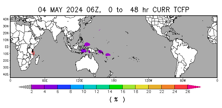
Tropical Storm Potential for the next 48 hours
Below is the Tropical Cyclone Formation Probability for the next 48 hours per the RAMMB.
Indian Ocean Tropical Storm Risk

North Indian Ocean
1. NORTH INDIAN OCEAN AREA (MALAY PENINSULA WEST TO COAST OF AFRICA):
   A. TROPICAL CYCLONE SUMMARY: NONE.
   B. TROPICAL DISTURBANCE SUMMARY: NONE.
   C. SUBTROPICAL SYSTEM SUMMARY: NONE.
South Indian Ocean
2. SOUTH INDIAN OCEAN AREA (135E WEST TO COAST OF AFRICA):
   A. TROPICAL CYCLONE SUMMARY: NONE.
   B. TROPICAL DISTURBANCE SUMMARY:
      (1) THE AREA OF CONVECTION (INVEST 99S) PREVIOUSLY LOCATED NEAR
9.2S 76.0E IS NOW LOCATED NEAR 9.6S 76.1E, APPROXIMATELY 253 NM EAST-
SOUTHEAST OF DIEGO GARCIA. ANIMATED ENHANCED INFRARED SATELLITE IMAGERY
(EIR) DEPICTS A GRADUALLY CONSOLIDATING LLCC WITH FLARING CONVECTION AND
ELEVATED WINDS BEGINNING TO WRAP ALONG THE NORTHEASTERN PERIPHERY INTO
THE EASTERN QUADRANT AS DEPICTED IN A 291531Z METOP-B ASCAT PASS. 99S IS
CURRENTLY IN A MARGINALLY FAVORABLE ENVIRONMENT FOR FURTHER DEVELOPMENT
WITH VERY WARM (29-30 C) SEA SURFACE TEMPERATURES, MODERATE POLEWARD
OUTFLOW ALOFT, WHILE ALSO BEING PLACED WITHIN A POCKET OF LIGHTER
VERTICAL WIND SHEAR (10-15 KNOTS). A FACTOR THAT CAN NEGATIVELY AFFECT
THE SYSTEM IS A LARGE DRY AIR MASS TO THE WEST THAT WILL BE IN THE
DIRECT PATH OF 99S AS IT CONTINUES TO CONSOLIDATE. GLOBAL DETERMINISTIC
AND ENSEMBLE MODELS ARE IN GOOD AGREEMENT ON A SOUTHWESTWARD TRANSIT AND
SLIGHT INTENSIFICATION OVER THE NEXT 24-48 HOURS. MAXIMUM SUSTAINED
SURFACE WINDS ARE ESTIMATED AT 18 TO 23 KNOTS. MINIMUM SEA LEVEL
PRESSURE IS ESTIMATED TO BE NEAR 1007 MB. THE POTENTIAL FOR THE
DEVELOPMENT OF A SIGNIFICANT TROPICAL CYCLONE WITHIN THE NEXT 24 HOURS
REMAINS LOW.
      (2) NO OTHER SUSPECT AREAS.
   C. SUBTROPICAL SYSTEM SUMMARY: NONE.//
NNNN
back to the top Northwest Pacific and South Pacific Tropical Storm Risk
Northwest Pacific Ocean
1. WESTERN NORTH PACIFIC AREA (180 TO MALAY PENINSULA):
   A. TROPICAL CYCLONE SUMMARY: NONE.
   B. TROPICAL DISTURBANCE SUMMARY: NONE.
   C. SUBTROPICAL SYSTEM SUMMARY: NONE.
South Pacific Ocean
2. SOUTH PACIFIC AREA (WEST COAST OF SOUTH AMERICA TO 135 EAST):
   A. TROPICAL CYCLONE SUMMARY: NONE.
   B. TROPICAL DISTURBANCE SUMMARY: NONE.
   C. SUBTROPICAL SYSTEM SUMMARY: NONE.//
NNNN
back to the top
Australia - Western Region Tropical Storm Risk
IDW10800
Australian Government Bureau of Meteorology
Western Australia

Updated Tropical Cyclone Outlook for the Western Region
Issued at 3:08 am WST on Sunday 8 May 2022
for the period until midnight WST Tuesday 10 May 2022.

Existing Cyclones in the  Western Region:

Nil

Potential Cyclones:

Tropical Cyclone Karim (36U) was located near 9.5S 90.1E at 2am WST Sunday,
just to the north of the Western Region. It is forcast to move into the region
during Sunday morning.

TC Karim will to continue moving towards the south to southeast over the coming
days. It is expected to maintain tropical cyclone intensity until it weakens in
the middle of the week, over open waters well to the west of the WA mainland.

TC Karim is expected to remain far enough west of the Cocos (Keeling) Islands
for there to be no direct impacts from this system, however shower and
thunderstorm activity should continue into early next week.

Likelihood of this system being a tropical cyclone in the Western Region on:
Monday          High
Tuesday         High


No other significant lows are expected in the region for at least the next 7
days.

Likelihood of another system being a tropical cyclone in the Western Region on:
Monday          Very Low
Tuesday         Very Low

NOTES: The likelihood is an estimate of the chance of each system being a
tropical cyclone in the Region for each day.
Very Low:     less than 5%                 Moderate:     20 to 50%
Low:          5% to 20%                    High:         over  50%

The Western Region refers to the Indian Ocean between Longitudes 90-125E and
south of 10S.


Copyright Commonwealth of Australia 2011, Bureau of Meteorology (ABN 92 637 533
532).  Users of these web pages are deemed to have read and accepted the
conditions described in the Copyright, Disclaimer, and Privacy statements
(http://www.bom.gov.au/other/copyright.shtml).
Australia - Northern Region Tropical Storm Risk
IDD10610
Australian Government Bureau of Meteorology
Northern Territory

Tropical Cyclone Outlook for the Northern Region, including the Gulf of Carpentaria
Issued at 2:15 pm CST on Saturday 30 April 2022
for the period until midnight CST Tuesday 3 May 2022.

Existing Cyclones in the  Northern Region:

Nil.

Potential Cyclones:

There are no significant lows in the region and none are expected to develop
within the next 7 days.

Likelihood of a tropical cyclone in the Northern Region on:
Sunday          Very Low
Monday          Very Low
Tuesday         Very Low


This will be the final Tropical Cyclone Outlook for the Northern Region until 1
November 2022.

NOTES: The likelihood is an estimate of the chance of each system being a
tropical cyclone in the Region for each day.
Very Low:     less than 5%                 Moderate:     20 to 50%
Low:          5% to 20%                    High:         over  50%

The area of coverage for this outlook is the Ocean area south of 9S, between
125E and 142E, including the Gulf of Carpentaria, but excluding the area around
Timor (northwest of 11S 125E, 11S 128E, 9S 128E).


Copyright Commonwealth of Australia 2011, Bureau of Meteorology (ABN 92 637 533
532).  Users of these web pages are deemed to have read and accepted the
conditions described in the Copyright, Disclaimer, and Privacy statements
(http://www.bom.gov.au/other/copyright.shtml).
Australia - Eastern Region Tropical Storm Risk
IDQ10810
Australian Government Bureau of Meteorology
Queensland

Tropical Cyclone Outlook for Coral Sea
Issued at 2:30 pm EST on Saturday 30 April 2022
for the period until midnight EST Tuesday 3 May 2022.

Existing Cyclones in the  Eastern Region:

Nil.

Potential Cyclones:

There are no significant tropical lows currently in the region and none are
expected for the next 7 days.

Likelihood of a tropical cyclone in the Eastern Region on:
Sunday          Very Low
Monday          Very Low
Tuesday         Very Low


This will be the final Tropical Cyclone Outlook for the Eastern Region until 1
November 2022.

NOTES: The likelihood is an estimate of the chance of each system being a
tropical cyclone in the Region for each day.
Very Low:     less than 5%                 Moderate:     20 to 50%
Low:          5% to 20%                    High:         over  50%

The area of coverage for this outlook is the Coral Sea and northern Tasman Sea
west of 160E.


Copyright Commonwealth of Australia 2011, Bureau of Meteorology (ABN 92 637 533
532).  Users of these web pages are deemed to have read and accepted the
conditions described in the Copyright, Disclaimer, and Privacy statements
(http://www.bom.gov.au/other/copyright.shtml).
back to the top
Fiji Tropical Storm Risk
WWPS21 NFFN 300600
Tropical Disturbance Summary For area Equator to 25S, 160E to 120W
ISSUED FROM RSMC NADI Mar 300708 UTC.

NO SIGNIFICANT TROPICAL DISTURBANCE ANALYSED OR FORECAST IN THE AREA.

*******************************************************************
back to the top
Eastern Pacific Tropical Storm Risk

000
ABPZ20 KNHC 010512
TWOEP

Tropical Weather Outlook
NWS National Hurricane Center Miami FL
1000 PM PST Sun Nov 30 2025

For the eastern and central North Pacific east of 180 longitude:

Tropical cyclone formation is not expected during the next 7 days.

This is the last regularly scheduled Tropical Weather Outlook of the
2025 Hurricane Season. Routine issuance of the Tropical Weather
Outlook will resume on May 15, 2026 for the eastern North Pacific
and on June 1, 2026 for the central North Pacific. During the
off-season, Special Tropical Weather Outlooks will be issued as
conditions warrant.

$$
Forecaster Gibbs
Atlantic Tropical Storm Risk

000
ABNT20 KNHC 302304
TWOAT

Tropical Weather Outlook
NWS National Hurricane Center Miami FL
700 PM EST Sun Nov 30 2025

For the North Atlantic...Caribbean Sea and the Gulf of America:

Tropical cyclone formation is not expected during the next 7 days.

This is the last regularly scheduled Tropical Weather Outlook of the
2025 Atlantic Hurricane Season. Routine issuance of the Tropical
Weather Outlook will resume on May 15, 2026. During the off-season,
Special Tropical Weather Outlooks will be issued as conditions
warrant.

$$
Forecaster Bucci
back to the top
Central Pacific Tropical Storm Risk

ACPN50 PHFO 011059
TWOCP

Tropical Weather Outlook
NWS Central Pacific Hurricane Center Honolulu HI
Issued by NWS National Hurricane Center Miami FL
800 PM HST Sun Nov 30 2025

For the central North Pacific...between 140W and 180W:

Tropical cyclone formation is not expected during the next 7 days.

This is the last regularly scheduled Tropical Weather Outlook of
the 2025 Hurricane Season.  Routine issuance of the Tropical
Weather Outlook will resume on June 1, 2026. During the
off-season, Special Tropical Weather Outlooks will be issued as
conditions warrant.

$$
Forecaster Gibbs
NNNN
back to the top
Servicio Meteorológico Nacional - Atlantic
Servicio Meteorológico Nacional - Eastern Pacific
back to the top
site by Hayley Croft
Hi, I'm Hayley. Did you know that I run this site out of my own pocket? So if you'd like to help support this site:
- Tell your friends about Cyclocane
- Buy something through this Amazon Cyclocane link
- make a donation - totally optional but completely appreciated
Make a monthly donation or a one-time donation to help support ongoing costs with Cyclocane.
Play solitaire and track all of the cyclocane storms at the same time at Hurricane Solitaire.