Cyclocane
( cyclocane is a CYCLOne and hurriCANE tracker by hayley )
English Español Deutsch Français 日本語
This is the final warning / advisory for this storm as it has weakened below warning levels and/or the storm system is no longer a tropical cyclone.
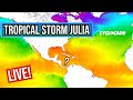
JULIA Current Status
...THE REMNANTS OF JULIA COULD PRODUCE FLASH FLOODING ACROSS CENTRAL AMERICA AND SOUTHERN MEXICO THROUGH TUESDAY...
Current Wind Speed 25 knots / 30 MPH
Max Predicted Wind Speed 25 knots / 30 MPH at

JULIA Land Hazards
- RAINFALL - Julia is expected to produce the following rainfall accumulations through Tuesday:
- SURF - Life-threatening surf and rip current conditions are possible today along the coasts of El Salvador and Guatemala. Please consult products from your local weather office.
JULIA Tracker
JULIA Satellite Loop

JULIA Alternate Tracking Map
JULIA Spaghetti Models
Spaghetti models for JULIA can be found here:
JULIA Watches and Warnings

Remnants Of JULIA Tropical Cyclone Update
Remnants Of JULIA Public Advisory
000
WTPZ33 KNHC 102034
TCPEP3

BULLETIN
Remnants Of Julia Advisory Number  18
NWS National Hurricane Center Miami FL       EP182022
400 PM CDT Mon Oct 10 2022

...THE REMNANTS OF JULIA COULD PRODUCE FLASH FLOODING ACROSS
CENTRAL AMERICA AND SOUTHERN MEXICO THROUGH TUESDAY...


SUMMARY OF 400 PM CDT...2100 UTC...INFORMATION
----------------------------------------------
LOCATION...15.0N 91.6W
ABOUT 80 MI...125 KM WNW OF GUATEMALA CITY GUATEMALA
MAXIMUM SUSTAINED WINDS...30 MPH...45 KM/H
PRESENT MOVEMENT...NW OR 305 DEGREES AT 15 MPH...24 KM/H
MINIMUM CENTRAL PRESSURE...1006 MB...29.71 INCHES


WATCHES AND WARNINGS
--------------------
There are no coastal watches or warnings in effect.


DISCUSSION AND OUTLOOK
----------------------
At 400 PM CDT (2100 UTC), the remnants of Julia were located near
latitude 15.0 North, longitude 91.6 West. The remnants are moving
toward the northwest near 15 mph (24 km/h), and this motion is
expected to continue today.

Maximum sustained winds are near 30 mph (45 km/h) with higher
gusts, primarily over water.  This system should further weaken
today.

The estimated minimum central pressure is 1006 mb (29.71 inches).


HAZARDS AFFECTING LAND
----------------------
Key messages for Julia can be found in the Tropical Cyclone
Discussion under AWIPS header MIATCDEP3 and WMO header WTPZ43 KNHC
and on the web at hurricanes.gov/text/MIATCDEP3.shtml.

RAINFALL:  Julia is expected to produce the following rainfall
accumulations through Tuesday:

*El Salvador and southern Guatemala...additional 1 to 4 inches,
isolated storm totals of 15 inches
*Isthmus of Tehuantepec in Mexico...3 to 6 inches, isolated 10
inches

The threat of flash flooding continues across the Isthmus of
Tehuantepec in Mexico through Tuesday.  Across Central America, the
flash-flooding risk is decreasing, but some areas of additional
flooding remain possible.

SURF:  Life-threatening surf and rip current conditions are possible
today along the coasts of El Salvador and Guatemala. Please consult
products from your local weather office.


NEXT ADVISORY
-------------
This is the last public advisory issued by the National Hurricane
Center on this system. For additional information on the remnant low
please see High Seas Forecasts issued by the National Weather
Service, under AWIPS header NFDHSFEPI, WMO header FZPN02 KWBC, and
on the web at ocean.weather.gov/shtml/NFDHSFEPI.php


$$
Forecaster Blake
Public Advisory not available for this storm.
Remnants Of JULIA Forecast Discussion
000
WTPZ43 KNHC 102034
TCDEP3

Remnants Of Julia Discussion Number  18
NWS National Hurricane Center Miami FL       EP182022
400 PM CDT Mon Oct 10 2022

Surface observations and satellite imagery indicate that the
low-level circulation of Julia has opened up into a trough of low
pressure extending from offshore of Guatemala to extreme
southeastern Mexico.  Thus it is no longer a tropical cyclone, and
this is the last advisory.  The wind speed is set to 25 kt
based on earlier scatterometer data on the fringe of the
system.  The main hazard with the remnants of Julia is heavy
rainfall, which is likely to continue over portions of Central
America today and southern Mexico through tomorrow.

The remnants of Julia could also contribute to a new tropical
cyclone development offshore of southern Mexico later this week, so
please see the latest eastern North Pacific Tropical Weather Outlook
for further details.


Key Messages:

1. The threat of flash flooding continues across the Isthmus of
Tehuantepec in Mexico through Tuesday.  Across Central America, the
flash flooding risk is decreasing, but some areas of additional
flooding remain possible.


FORECAST POSITIONS AND MAX WINDS

INIT  10/2100Z 15.0N  91.6W   25 KT  30 MPH...REMNANTS OF
 12H  11/0600Z...DISSIPATED

$$
Forecaster Blake
JULIA storm path from NHC
| Time | Speed | Location | Status |
|---|---|---|---|
| 25 knots | 15.0, -91.6 | REMNANTS OF | |
| 0 knots | translation missing: en.DISSIPATED |
site by Hayley Croft
Want to help support this site?
- Tell your friends about Cyclocane
- make a donation - totally optional but completely appreciated
Make a monthly donation or a one-time donation to help support ongoing costs with Cyclocane.
Play solitaire and track all of the cyclocane storms at the same time at Hurricane Solitaire.