Cyclocane
( cyclocane is a CYCLOne and hurriCANE tracker by hayley )
English Español Deutsch Français 日本語
PTC-THIRTEEN 現在の気象条件
現時点で風 30 knots / 35 MPH
予測最大風速 75 knots / 85 MPH at
勧告と警告、気象レーダー、衛星
current US watches/warnings

live tornado/thunderstorm tracker - tornadohq
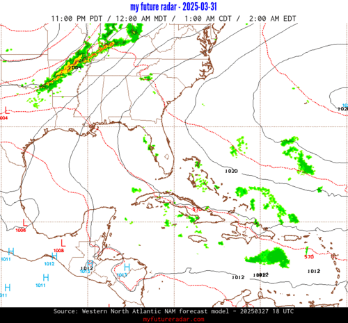
future radar imagery - my future radar
future radar imagery

(above image is an example of the Western North Atlantic page - see Atlantic future radar page for a full set of images)
If a tropical storm or hurricane is threatening land, you can check my future radar for an idea of what radar might look like as the storm approaches.
PTC-THIRTEEN 土地の危険
NWS Local Hurricane Statements
- No warnings
進路 PTC-THIRTEEN
PTC-THIRTEEN 衛星
NHCのPTC-THIRTEENの地図
PTC-THIRTEEN 数値予報モデル
PTC-THIRTEEN 勧告と警告

PTC-THIRTEEN デタ NHC
| 時間 | 時間 | 中心位置 | status |
|---|---|---|---|
| 30 ノット | 11.7, -69.1 | ||
| 35 ノット | 12.0, -70.7 | 熱帯性暴風 | |
| 40 ノット | 12.6, -73.6 | ||
| 50 ノット | 13.0, -76.7 | ||
| 60 ノット | 13.0, -79.6 | ||
| 75 ノット | 13.1, -81.9 | ||
| 75 ノット | 13.3, -84.1 | translation missing: jp.INLAND | |
| 35 ノット | 14.8, -89.1 | translation missing: jp.INLAND | |
| 0 ノット | translation missing: jp.DISSIPATED |
site by Hayley Croft
Want to help support this site?
- Tell your friends about Cyclocane
- make a donation - totally optional but completely appreciated
Make a monthly donation or a one-time donation to help support ongoing costs with Cyclocane.
Play solitaire and track all of the cyclocane storms at the same time at Hurricane Solitaire.

